
On October 19, the Culpeper County Planning Commission is hosting a special session to discuss the second draft, and will likely recommend its approval before sending it to the Board of Supervisors.
Our Region
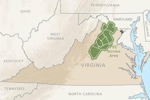 PEC focuses on nine counties and one city in the northern Piedmont of Virginia: Albemarle, Charlottesville, Clarke, Culpeper, Fauquier, Greene, Loudoun, Madison, Orange, and Rappahannock.
We also team with local organizations to promote thriving communities and healthy natural resources in a much larger region, including the Shenandoah Valley, the central Piedmont, and the Journey Through Hallowed Ground Corridor. In addition, we are proud to serve as fiscal sponsor of the Coalition for Smarter Growth, an organization that focuses on land use and policy in the greater Washington D.C. area.
Week of October 17, 2022: Greene County PC to review land use policies; Charlottesville Council to provide budget direction
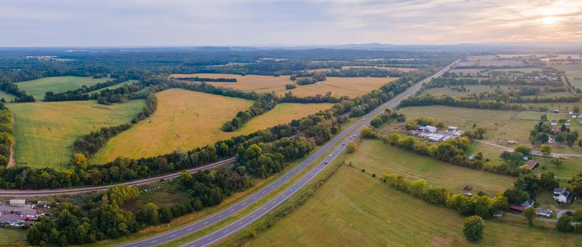
We’re now well into autumn, and our local governments continue to be active in the last few weeks before the holiday season begins to really affect the schedule. This is a strange week with a lot of relatively technical meetings.
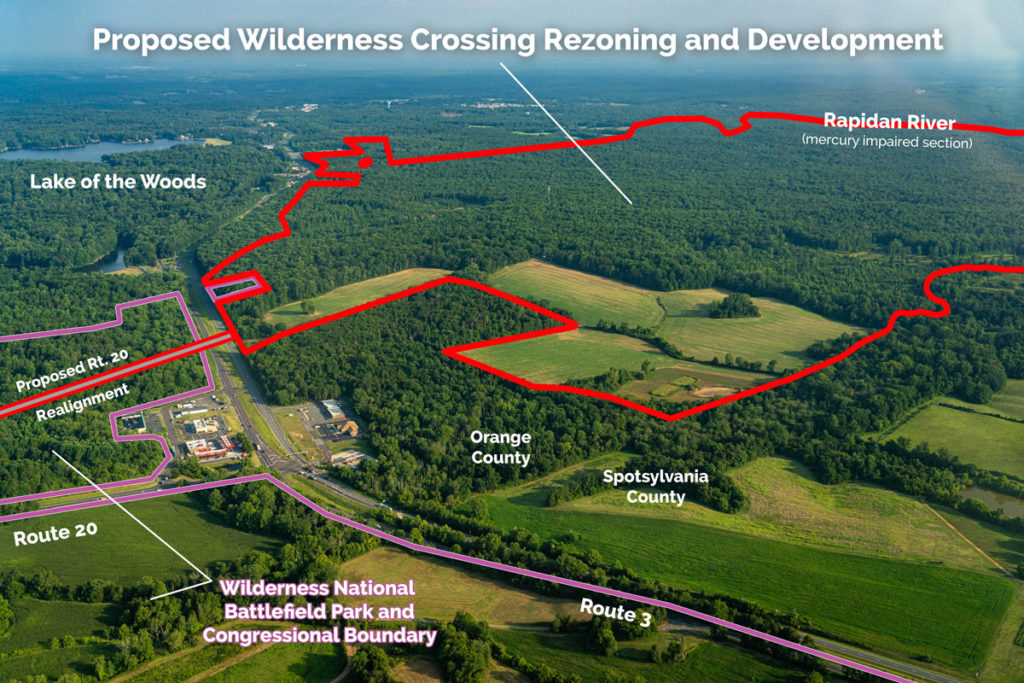
Wilderness Crossing Town Hall on Oct. 25
As reported in my last email, the Wilderness Crossing proposal continues to wind its way through the rezoning application process in Orange County.
Week Ahead for October 10, 2022: Car wash on Fifth Street in Charlottesville; Rezoning requested for Lake Anna Resort in Louisa; Albemarle PC to review 195-foot cell tower at Walnut Creek Park
Monday is a holiday, so the week starts with Tuesday. As with any week without a working Monday, that causes a very busy Tuesday. There’s a lot happening this week and here are some highlights of a week where most of the action is outside Charlottesville.
Week Ahead for October 3, 2022: Charlottesville City Council to consider collective bargaining ordinance; Albemarle Supervisors to get economic outlook; Fluvanna prepares for new Circuit Court judge
We are now in the fourth quarter of the year as measured by the calendar, or the second quarter as measured by Virginia’s fiscal year. On any given day, there are a lot of activities being conducted by public bodies and local governments. This newsletter aims to provide a weekly snapshot of what is happening, and as always, there is a lot happening.
Virginia’s Former Gold Mines with Priority Level for Reclamation – PEC Web Map
In 2022, The Piedmont Environmental Council was proud to partner with volunteers from UVA’s Clark Scholars program on a project to analyze the reclamation status of former gold mine sites throughout the Commonwealth. Using data pulled from the Virginia Department of Energy’s Mineral Mining online mapping interface, the student’s research enabled PEC to create a new WebMap that visually displays former mine sites “OLAC ranking,” a measure of prioritization for reclamation based on potential or assessed contamination.

Takeaways from the recent Warrenton Amazon Data Center Balloon Test
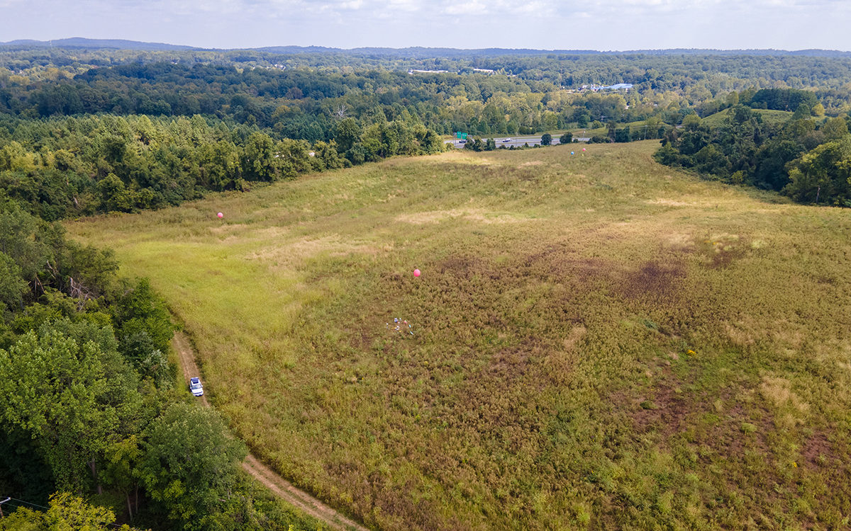
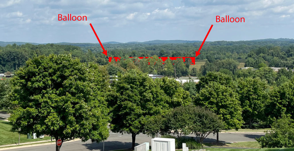
By now, you’ve probably read about the balloon test conducted by Wetland Studies and Solutions, Inc. for the proposed Amazon data center on Blackwell Road last Thursday, Sept. 15. If you had to travel to/from Warrenton on U.S. Route 17 or 15/29 Business or were at a number of different locations in Town you might have even seen the balloons themselves.
Here are photos/renderings of what we saw that day:
See all of the photos captured that day >>
The balloons may have been placed at the corners of the proposed 220,000-square-foot and 37-foot-high Amazon data center, but as you can see in the drone shot, two of the four balloons were quite close to each other. So it’s not clear whether that was true or not. While the balloon locations are a good starting point for determining the visual impact of the proposed data center, we should all be aware that they do not provide the full picture.
For instance, Amazon’s latest submission to the Town on September 9 failed to provide details on how the height of the balloon test was determined. Thus, we’re not sure if the height of the balloons accurately reflected all building elements that were detailed in that same submission. Amazon’s architects indicated that with the inclusion of a parapet wall (an extension of the wall at the edge of a roof) and other rooftop equipment, the tallest point of the building could reach just under 57 feet — 20 ft above the height of the building itself. It’s unclear if the balloons were at a height closer to 37 or 57 feet.
Additionally, the four balloons cover just a tiny fraction of the surface area of the proposed 220,00- square-foot building — only the outer corners of what would be filled in by the building — and the location of each of the balloons was influenced by the wind that day.
Most importantly, the balloon test did not include the removal of trees as proposed in the Tree Study prepared by Amazon’s representatives and included in the September 9 submission (see page 13) that shows substantial tree removal, particularly at the northern and western edges of the property, some of the most visible portions of the site to adjacent neighborhoods and Rt. 17.
Despite these limitations, the balloons were still visible from a number of different vantage points in Town. We prepared a viewshed analysis of the 37-foot data center building and presented this map to the community at our August 10 Town Hall. The analysis utilizes LiDAR data that encompasses current groundcover and topography to predict how visible the 37-foot elevation of the building would be within a 3-mile x 3-mile square.
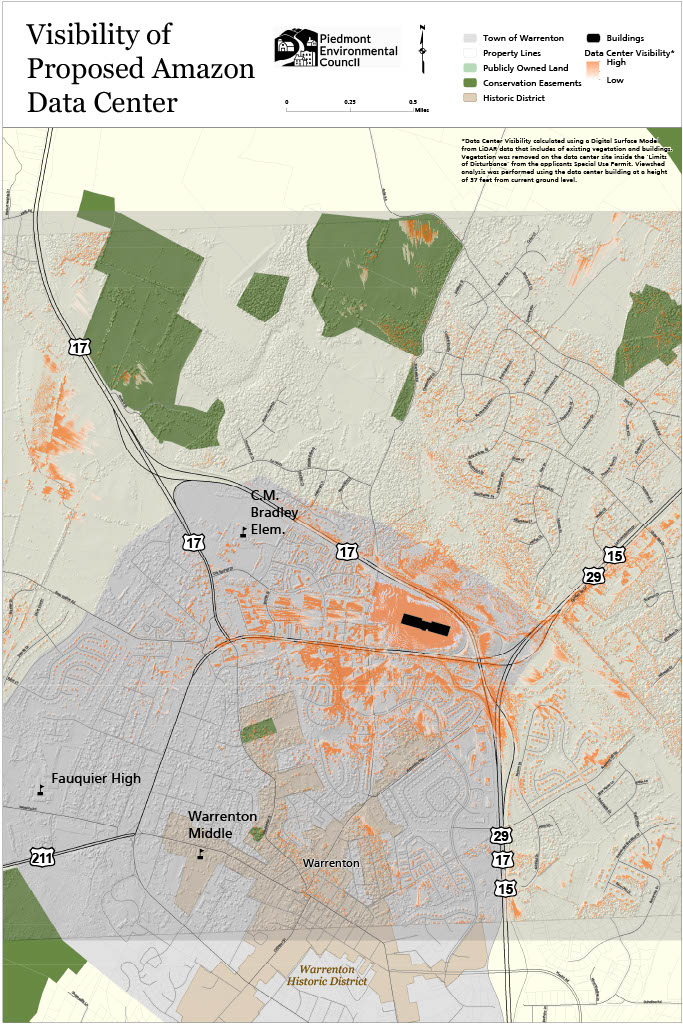
As we predicted, the balloons were visible from many of the areas we highlighted in red on our viewshed map, confirming the accuracy of our analysis. Again, it’s likely that the visual impacts are understated given the limitations of the balloon test.
This new information is all the more reason residents should come out and voice their concerns about the detriment this proposal will have on quality of life in the Town and County, including visual impacts of the data center on Warrenton’s gateway, numerous locations in Town, and the rural character that draws visitors and residents alike to this area.
Finally, the coalition, Citizens for Fauquier County, Protect Fauquier, and PEC, plan to hold another town hall on October 26 at the Highland School.
The Amazon Data Centers: Myths and Realities
Highland School Auditorium
597 Broadview Avenue, Warrenton, Virginia 20186
October 26, 2022 @ 7 – 9 p.m.
Come out to learn more about the Amazon data center proposals and the impact they could have on the Town of Warrenton and the County! We’ll also be sharing the actions you can take to oppose this proposal as we get closer to the Planning Commission’s decision.
Please don’t hesitate to reach out to PEC’s Fauquier Field Representative, Kevin Kask, with your thoughts or questions. He can be reached at [email protected] and (540) 347-2334 ext. 7046.
Return of the Grassland Birds
The new Virginia (formerly Piedmont) Grassland Bird Initiative (VGBI) is showing promising signs of returning those birds to the Virginia landscape. With grant funding, the program pays farmers to adopt bird-friendly best management practices.
Continuing the Climate Conversation: An update from Albemarle
PEC is ramping up our activities and role within the broader Comprehensive Plan update process, developing recommendations that we hope, based on our study of climate threats in Albemarle, can serve as a model for other PEC counties.
Soil is Alive: How to Keep it Healthy
Healthy soil can make as big a difference for home gardeners as it can for large-scale farmers. We sat down with Melissa Allen, District Manager at the John Marshall Soil and Water Conservation District to talk about the importance of and path to healthy soil.