

In late September 2013, Donald Trump’s Trump Virginia Acquisitions LLC submitted a plan to develop a property in the Albemarle County Rural Area south of Monticello. They want to develop the property — which is protected by a conservation easement — into a commercial golf course called the Trump National Golf Club. We have major concerns about its potential impacts on the surrounding community.
Our Region
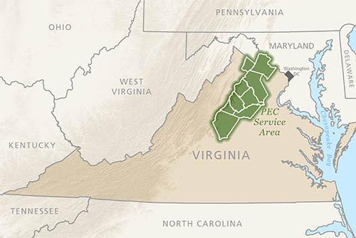 PEC focuses on nine counties and one city in the northern Piedmont of Virginia: Albemarle, Charlottesville, Clarke, Culpeper, Fauquier, Greene, Loudoun, Madison, Orange, and Rappahannock.
We also team with local organizations to promote thriving communities and healthy natural resources in a much larger region, including the Shenandoah Valley, the central Piedmont, and the Journey Through Hallowed Ground Corridor. In addition, we are proud to serve as fiscal sponsor of the Coalition for Smarter Growth, an organization that focuses on land use and policy in the greater Washington D.C. area.
Sacrificing History… For What?
Often environmentalists are told that we just 'say no' to things. To which I would argue — saying 'no' to a bad idea is a very important part of what we do. But it's not all we do. At The Piedmont Environmental Council we also strive to put forward constructive alternatives. That's why it's so frustrating to see the Virginia Department of Transportation, led by Sean Connaughton, make mega-projects like the Outer Beltway and Charlottesville Bypass its highest priority. Despite great arguments against both projects — fiscal, environmental, common sense arguments — and plenty of alternatives, VDOT is charging ahead. This text is from an email alert sent out on September 19, 2013:

When Mickey Came to Town
Virginia’s northern Piedmont is a beautiful and vibrant place—boasting of forests, rivers, mountains, farmland, thriving towns, and numerous historic and cultural resources. But all of this came under threat in November 1993, when the The Walt Disney Company made a surprise announcement that they planned to build an American history theme park near what was then the small town of Haymarket, VA—only four miles from Manassas Battlefield.
Expanding the Warrenton Branch Greenway
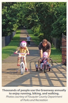
The Warrenton Branch Greenway is a treasured community resource in Old Town Warrenton. The 1.5 mile-long trail not only provides a great outdoor recreational space, but it is also an important historic resource—as it follows the old Orange and Alexandria Rail-road line that was built in the 1850s. Today, thousands of people use this trail annually to enjoy running, walking and biking.
Battle Maps
Full resolution maps of days one and two of the battle can be found by clicking on the maps embedded on this page.
Our Alternative — Rethinking the Bi-County Parkway
Our proposal, detailed in the report Rethinking the Bi-County Parkway, focuses on fixing east-west routes for commuters, it provides lower impact local road fixes and connections to help local residents, it preserves the Rural Crescent and Transition Area, and could allow for the roads to be closed through the Battlefield (although it’s not clear that would ultimately be necessary, due to the reduced traffic that would result from implementing the alternatives we’ve suggested).
Conservation Easements in Culpeper
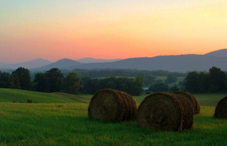
Virginia’s Piedmont is a unique place with exceptional natural resources, productive farms and forests, and a landscape steeped in history. The farms and forests in Culpeper Soil and Water Conservation District’s five-county region are vital to the financial well-being of the regional and state economy, and each year hundreds of thousands of tourists come to experience our natural wonders and historic heritage. This article was written for the Culpeper Soil and Water Conservation District’s Spring 2013 newsletter.
Transcript of WINA interview with former CTB member Jim Rich
Charlottesville Right Now, Thursday, May 30, 2013
Jim Rich, a former member of the Commonwealth Transportation Board, shares his thoughts on the Western Bypass.
CATCO Green Book
The Charlottesville-Albemarle Transportation Coalition (CATCO) is a citizen group formed in 1988 to respond to proposed improvements to the local Rt 29 corridor. Their objective was the development of real solutions to emerging congestion problems. Their work included opposition to the Western Bypass, specifically after it was elevated as a priority ahead of previously agreed upon, more effective solutions. The CATCO Green Book summarizes these efforts through 2000. It provides an invaluable digest and summary of the genesis of the Western Bypass and why this community has long opposed it.
Sprawling Development Proposed on Outskirts of Opal
Most everyone who travels south of Warrenton on Rt. 29 ends up stopping (at least momentarily) in Opal. On weekday mornings and weekend afternoons traffic gets backed up in both directions, with drivers struggling to turn on to Rt. 17 or get in and out of existing businesses.
This Thursday, the Fauquier County Planning Commission will consider a development proposal that would make the traffic situation worse. The proposal would open up more than 80 acres of agricultural land to strip-commercial development — putting a burden on County services like water, and ultimately detracting from future economic opportunities in the area. This text is from an email alert sent out on May 27th, 2013.