The following text was sent out via email on Nov. 1, 2023. Sign up for PEC email alerts →
Dear Supporter,
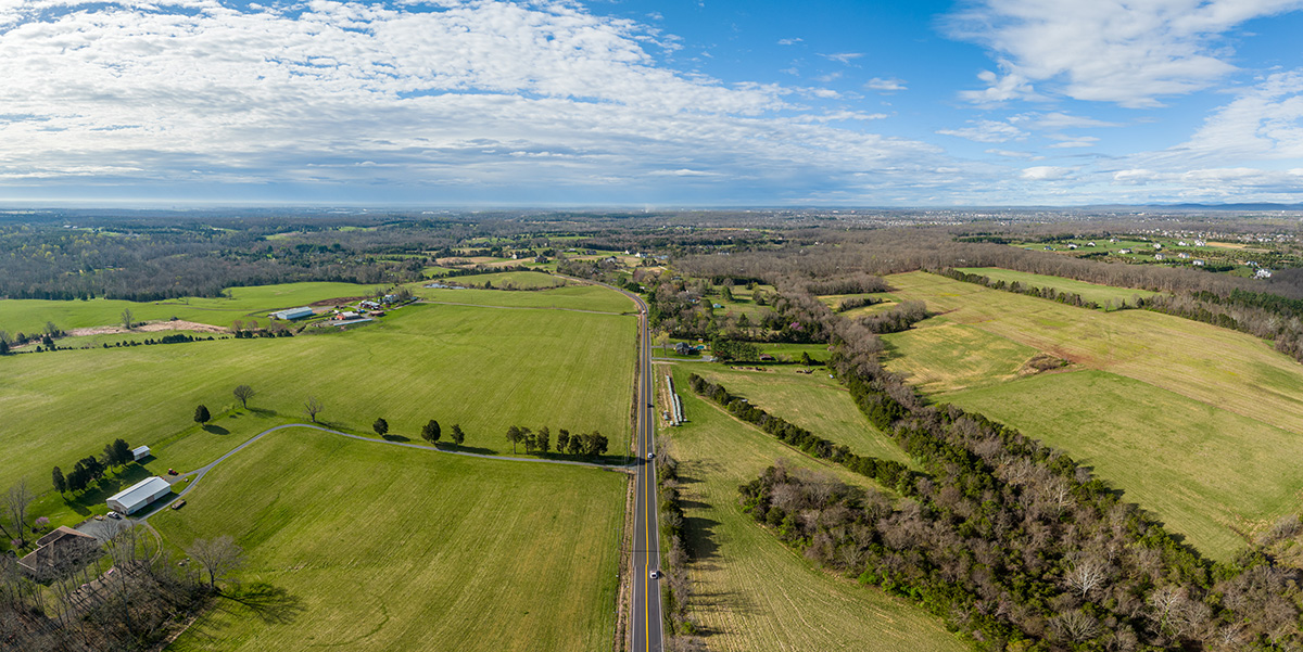
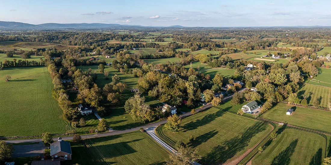
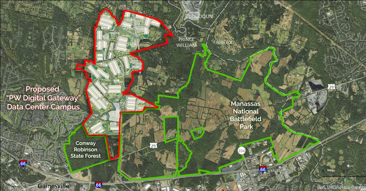
Since 2021, PEC has been supporting our partners’ heroic efforts to stop the largest data center campus in the world from being built on rural land next to Manassas National Battlefield Park, along Pageland Lane in Prince William County, Virginia.
The proposal, dubbed “Digital Gateway,” is massive and is projected to require around 3 gigawatts (GW) of energy. For context, that’s equivalent to the power used by 750,000 homes – roughly 5 times the number of households currently in Prince William County!
As I have tried to articulate concerns about the significant power needs and electrical infrastructure that would accompany this proposal, along with the regional impact, I have been stymied by the lack of detail in the application. As Prince William County staff pointed out recently in their recommendation for denial of the project, the proffers offered by the applicants do not commit to any particular building locations or footprints or substations.
Usually, a general concept plan is not only provided, but also committed to by the applicant. Neither of which has been done in this case. In fact, despite this being the most transformative land use proposal in Prince William County in decades, there is no rendering showing the full extent of what’s being proposed.
With Scissors and Tape
In my search for more detail, I found the applicant’s master plan recently submitted to the County as a part of the application. Although not legally binding, the document contained piecemeal illustrations showing first hints of approximate building locations and sizes. Unfortunately, these images showed only chunks of the project, spread out on 12 pages (see pgs 42 – pg 53). I searched the rest of the application package, but could not find anything showing all the buildings together.
Frustrated, and with time running out before the planning commission public hearing on Nov. 8 and the expected Board of Supervisors public hearing and vote on Dec. 12, I decided to get out scissors and tape and started cutting and piecing the images together myself.
They fit together perfectly and I was astonished at the end result: 37 buildings and 15 substations, with no allocated right of way for transmission lines connecting the new substations.
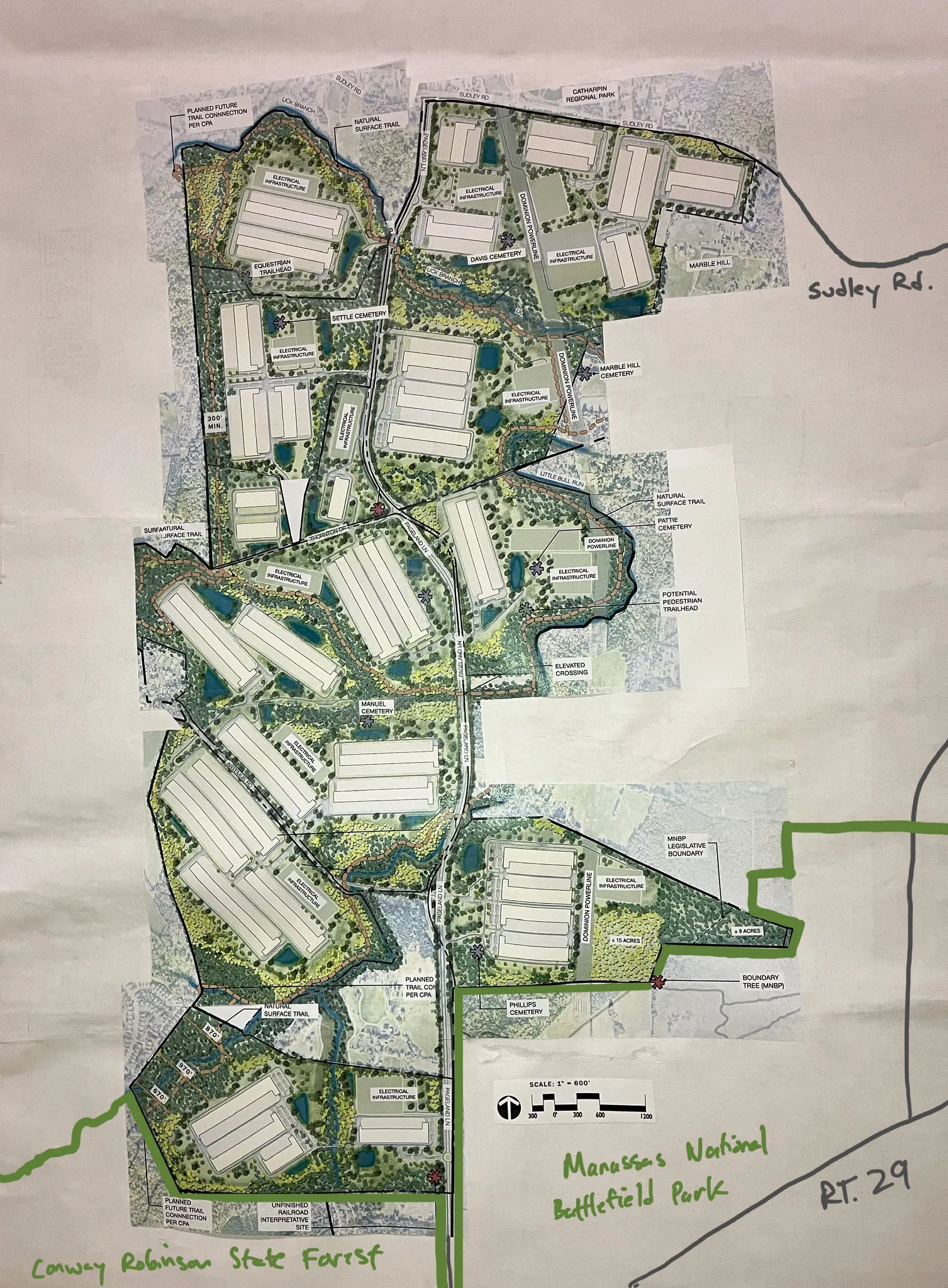
What does my stitched together version mean? It means that either a) much of the green space shown on these images would have to be cleared and used for transmission lines, or b) the utility would need to route lines and establish right-of-ways through the use of eminent domain on surrounding parcels that are not part of this application.
And this does not even address the question of how much the existing transmission grid would need to be expanded both within and outside of the site boundaries or if new lines would need to be brought in from another direction to serve the new high energy load, potentially taking land and impacting residents in Loudoun and Fauquier counties, and beyond.
Using the scale bar to estimate the square footage of the substations and data center buildings, I also found the illustrations themselves to be misleading. They create an overly rosy picture of what’s being proposed. Some of the shapes delineating substations were as small as three acres, and those delineating buildings totaled just under six million square feet. However, according to Dominion, substations actually require 6 to 10 acres. And, the illustrations show well under the 23 million square feet of data centers the application would allow.
What I deduce from all of this is: the project would have much greater impacts than decision-makers imagine, and the trails and buffers that are part of the illustrations are speculative, at best.
Decision Time Fast Approaching
I’m sharing this information with you today to draw attention to Digital Gateway and the potential industrial future ahead for the Pageland Lane corridor in Manassas. I also want to highlight the regional ramifications in regard to energy infrastructure. There is so much still unplanned for:
- We don’t know where the power for this massive data center development will come from;
- We don’t know the true size of the data center buildings, or which ones will be the maximum 3-story height of 83’ tall;
- We don’t know how many transmission line upgrades, expansions, or additions it would require (both within and outside of the site).
| Call to Action – Key Public Hearing Dates! |
|---|
| The Prince William Planning Commission public hearing will take place next Wednesday, November 8, starting at 2pm. Nov 8: Planning Commission Hearing James J. McCoart Administration Building 1 County Complex Court Prince William, VA 22192 [meeting agenda] The meeting will be held in the board chambers. Come speak in person or sign up in advance to speak virtually (the sign up link is included in the agenda and will go ‘live’ on Nov 2 and close at 5pm on Nov 7). Or you can submit written comments to the Planning Commission on “Digital Gateway – Rezoning REZ2022-00036, Rezoning REZ2022-00033, and Rezoning REZ2022-00032.” Our friends at the National Parks Conservation Alliance and Coalition to Protect Prince William are hosting info sessions via Zoom for anyone who wants to prepare in advance. You can join on either Sunday, Nov 5 at 5pm or Monday, Nov 6 at Noon to learn more. Dec 12: Board of Supervisors Meeting James J. McCoart Administration Building The Board of Supervisors is expected to hold their public hearing on Dec 12 starting at 10am. To sign up to speak or submit written comments for that meeting, visit: https://pwcgov.granicusideas.com/ |
Zooming Out
The proposed Digital Gateway project is the largest data center campus proposal in the world and equivalent in size to nearly all of Data Center Alley in Loudoun County, concentrated along Pageland Lane between the Manassas National Battlefield and the Conway Robinson State Forest. In this message, I have focused on the negative impacts of this development accruing to residents and ratepayers alike due to the extensive expansions of the energy system and electric grid.
However, other concerns with this project mentioned in previous alerts from PEC remain:
- It would pollute drinking water supplied by the Occoquan watershed (Fairfax Water has asked Prince William County to study these impacts prior to approving the rezonings to no avail).
- It paves the way for a significant portion of the sprawl-inducing Outer Beltway with the proposed widening of Pageland Lane.
- It would greatly diminish nearby historical and recreational resources
We are urging the Prince William County Planning Commission to slow down and at a minimum make a motion to table the vote until more information is made available related to the extensive energy needs resulting from this project. Such an action is critical to Prince William residents and everyone who will experience the broader ramifications of the County’s decision.
Sincerely,
Julie Bolthouse
Director of Land Use
[email protected]
540-347-2334 ext. 7042