Prince William County is evaluating three different land use changes that would introduce industrial and residential sprawl into the Rural Crescent, to the detriment of water quality, wildlife habitat, agriculture, historic resources, tourism and the rural atmosphere. Prince William adopted the concept of the Rural Crescent back in 1998 to stop sprawling development and its costly impacts on the public drinking water supply, the rural economy, and public infrastructure (e.g. water, sewer and road expansions to widely dispersed rural areas of the County). These three land use changes under consideration would eliminate that concept and represent a complete reversal in policy.
Three proposed land use changes
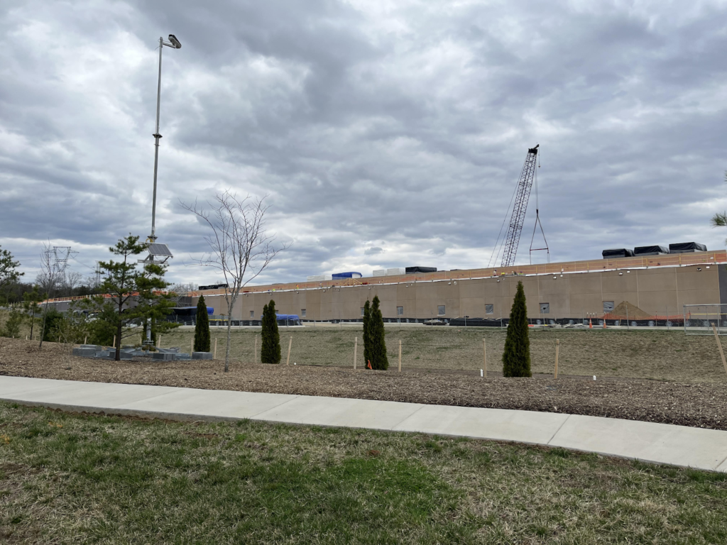
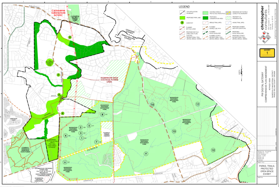
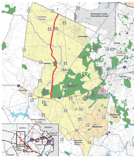
- Digital Gateway and Road Expansion – The Prince William Digital Gateway is a plan for a data center corridor and major road expansion along Pageland Lane. Two facets of the Digital Gateway are moving forward in tandem: 1) the comprehensive plan amendment designating a 2,133-acre study area for data center development, and 2) a rezoning proposal allowing 7.9 million square feet of data centers to be built on 812 acres within that study area. Accompanying the data center corridor proposal is the widening of Pageland Lane to four-lanes and reference to other transportation projects such as an extension of Rt. 234 North over I-66 to Pageland Lane. These changes are largely reminiscent of past plans for a Bi-County Parkway and would match up with current plans in Loudoun County to widen Northstar Blvd./Rt. 705 to six lanes down to Sanders Lane in Prince William.
- Substantial Comprehensive Plan Changes – The County is currently in the midst of a significant update to its comprehensive plan. The draft land use and sanitary sewer plans for the update would effectively eliminate the Rural Crescent by designating a substantial amount of agricultural land for suburban/industrial development and permitting the extension of water and sewer lines to these areas. The plan also includes a large new industrial area along Rt. 28 just west of Nokesville on the Fauquier/Prince William County line.
- Expansion of the Data Center Opportunity Zone Overlay – The County is currently considering an expansion of the Data Center Opportunity Zone Overlay, areas where the County has already determined data centers would be most appropriate. Things have been relatively quiet on this proposal, but the Overlay could very well go beyond what is proposed with Digital Gateway and expand into more rural areas that are unfit for data centers. This push is also at odds with continued reporting that there is already plenty of land in the current zone overlay to accommodate data center growth. [Data show Prince William County is on track to overtake Loudoun in data center development – Prince William Times, May 12, 2022]
Digital Gateway
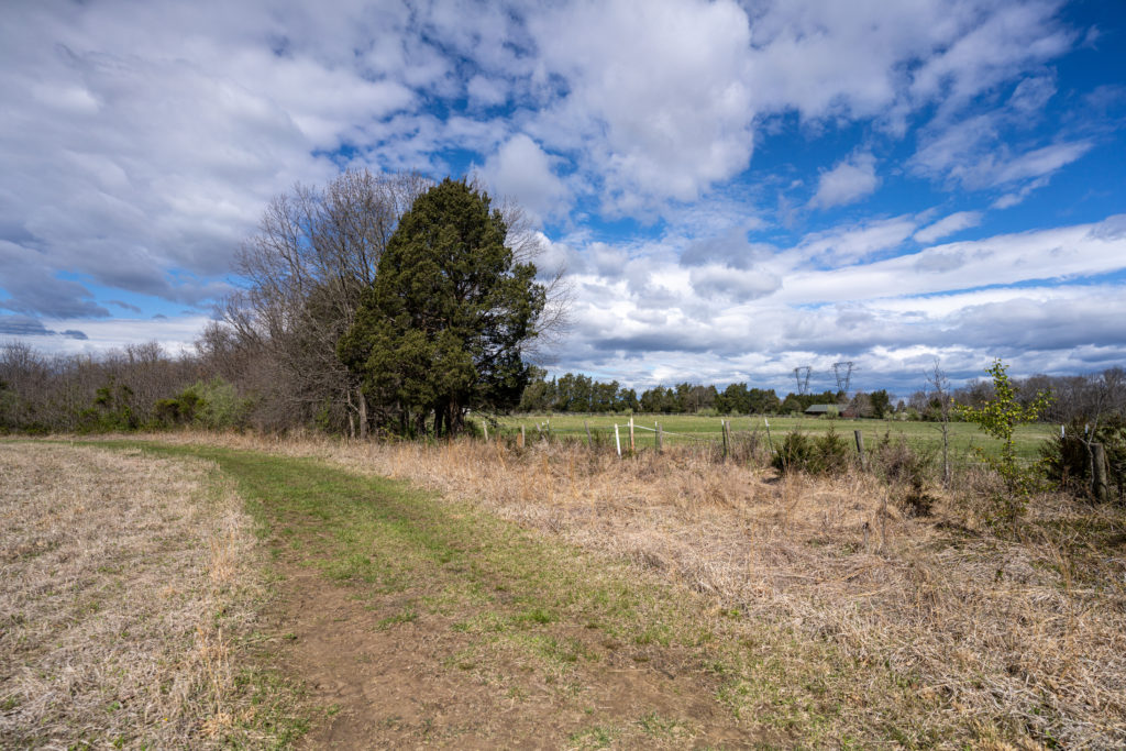
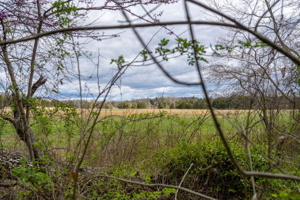
The Digital Gateway comprehensive plan amendment has undergone a few rounds of review with County staff in which the significant negative impacts on natural and historic resources were clearly laid out. Although things like visual screening and setbacks from streams can be incorporated, millions of square feet of tall blocky buildings, parking, and the preliminary land clearing and grading cannot be sufficiently mitigated and will have devastating and permanent effects on those resources.
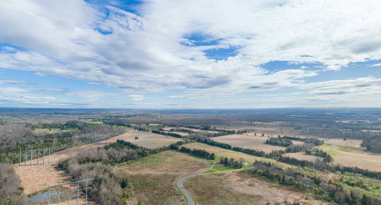
The comprehensive plan amendment and rezoning applications also remain vague and fail to delineate specific building locations, design elements, or specific actions to mitigate their effects on resources and views. While the plan touts more trail connections, those trail connections will be in front of large, fenced-in data center complexes and will come at the cost of a complete change in setting and more traffic on a widened four-lane divided Pageland Lane. All of this would be right across from Manassas National Battlefield Park, which draws over 500,000 visitors a year.
Throughout the review process, several prominent/expert/regional voices have come out in opposition of the proposed land use changes, including the County’s own Watershed Management Department, the National Parks Service, which is concerned about inadequate protections for historic resources within a National Register District, and Fairfax Water, which highlighted the need for the County to conduct its own independent water study.
Our coalition hired a consultant to estimate the sediment and stormwater runoff impacts of the current 812 acres requested for rezoning for the Digital Gateway. That analysis found that 28,000-37,000 tons more sediment and over 200 million gallons more stormwater than now would flow into the Occoquan Reservoir watershed, which is a drinking water resource for over 800,000 people in Northern Virginia, including much of eastern Prince William County. This assumes that all construction and erosion/sediment protocols are followed. The Applicant has focused on the idea that the data centers will reduce downstream nutrient pollution because the rural areas will now be served by public sewer. This is a questionable conclusion in itself considering the incredible amount of development proposed and potential increases of fertilizer use in landscaping. More importantly, the Applicant is also not acknowledging sediment increases and stormwater pollutants such as salt, heavy metals, oil and/or other petroleum products.
It’s the County’s job to assess the impacts of the Digital Gateway proposal before voting on it. The County already has access to the Occoquan Watershed and Reservoir Model, which can be used to predict how future land use coverages would affect levels of nitrogen, phosphorus, sediment and other pollutants of concern, such as sodium, in the Occoquan Reservoir. Fairfax Water has urged the County to utilize this model to inform its planning process, but whether Prince William County will listen remains to be seen.
The Board of Supervisors has scheduled a work session on June 7 at 2 p.m. to discuss whether to study watershed impacts. Given the number of people who rely on this watershed for clean drinking water, this shouldn’t be up for the debate.
Another top-level concern is the visual impact of data centers in this predominantly rural area. Although the applicant has submitted a sightline analysis concluding that certain screening measures could protect some of Manassas Battlefield’s most important views, that analysis was limited. The applicant has purposely delayed a more detailed analysis of the viewshed impacts until after the land is redesignated for data centers in the comprehensive plan amendment. We believe this is disingenuous and that any visibility of the data centers from within the park would be detrimental to the recreational enjoyment of nature and quiet, somber experience of history visitors expect.
We continue to hold that such a large development and redesignation of land demands a full analysis of environmental and fiscal impacts and should be made within an inclusive community planning process rather than proposed piecemeal by landowners. When this many key stakeholders and educated professionals find issues with a proposal, the County should listen.
Bi-County Parkway
Despite the recent announcement by the Board of Supervisors that the Bi-County Parkway is “off the table,” the current Digital Gateway rezoning application still requests that Pageland Lane be widened to four lanes along the previously proposed route of the Bi-County Parkway (widely opposed by Prince William County residents in the past). Loudoun County includes the Bi-County Parkway in its transportation plans with Northstar Blvd, which turns into Sanders Lane at the County line, planned to be expanded to six lanes. If the road widening proposed on Pageland Lane continued to Sanders Lane and up to Loudoun, this would complete the planned path of the Bi-County Parkway as envisioned in 2005. With some residents on Sanders Lane also considering selling to data center companies, this seems quite plausible. The Board may not be calling it the “Bi-County Parkway” anymore, but widening the once rural two-lane roads to four lanes creates the more direct and higher capacity route from I-95 to Dulles, which was the proposed 2005 Bi-County Parkway plan.
Comprehensive Plan Update
In continuing to pursue its comprehensive plan update, the County proposed three policies that would introduce more development and sprawl into the County’s rural crescent and make it impossible for the County to maximize its existing infrastructure investments:
- Encourage residential densities that are largely consistent with suburban development in the rural crescent; specifically, doubling of the allowable residential density to one home per five acres on approximately 78,384 acres under a new Agriculture and Forestry designation, and creation of new Village, Hamlet and Conservation Residential (cluster development) land use designations that allow even higher densities at locations throughout.
- Designating approximately 1,800 acres along Rt. 28 in Nokesville for industrial uses.
- Permitting the extension of water and sewer lines into the rural crescent to serve these higher density residential developments and newly designated industrial areas.
Because the comprehensive plan does not contain specific design standards, there is no telling what future development in any of these areas would look like. What is clear is that the proposed density and the sewer and road infrastructure needed to support it will lead to costly residential sprawl. The one-home-per-five-acres density under the Agriculture and Forestry designation and one-home-per-two-to-five-acres in conservation residential and hamlet designations are consistent with large-lot residential subdivisions characteristic of sprawl.
Similarly, designating 1,800 acres in Nokesville for industrial development would lead to industrial sprawl along the Rt. 28 corridor. Industrial development in this area is unsupported by community input, and no studies of the potential land use conflicts and traffic implications have been done. We are concerned this proposal could have serious impacts to existing well users in the area, the overall agricultural economy, and the rural road network. Based on our own preliminary traffic estimates, we believe this land use designation could double the existing daily vehicle traffic and could triple the existing truck traffic on Rt. 28 in both directions. This not only has a huge impact on Rt. 28 through Prince William, but also through neighboring Fauquier County, where the road is planned to remain a rural two-lane road.
How Much Growth Exactly?
Can the County guarantee that taxpayers won’t bear ANY of the costs of extending sewer lines into the rural area? While the County claims that “growth pays for growth”, absent a binding agreement or a willingness to pay for the operation and maintenance of that infrastructure, this massive expansion will still cost the taxpayers in the long term. Plus, we know from experience that although the plan is that growth will pay for growth, when service levels start to fail, public pressure builds for additional spending on infrastructure projects that were supposed to be paid for by development.
The comprehensive plan update is intended to accommodate 2040 population projections from the Metropolitan Washington Council of Governments (MWCOG) adopted by the Board of Supervisors in 2016. The 2040 projections estimated a total County population of 569,500 (a 79,250 resident increase from the current population of approximately 490,250). This projected increase would require the County to plan for another 30-40,000 households (see pages 48-56 of the staff report). According to the County, about 20-25,000 units of that projected increase are already planned for in its currently adopted small area plans. The County has yet to adopt two additional small area plans that will likely accommodate more dwelling units. The County’s latest Build-Out Analysis from 2020 anticipates approximately 19,685 units to be developed outside of small area plans under existing zoning. Therefore, the County’s current land use policies could accommodate at least 39,685 units, or the entirety of the growth projected by MWCOG in 2016.
Planning for growth beyond the County’s developed area attracts development to more removed, often rural areas where land is cheaper, pulling redevelopment opportunities away from existing communities in need of investment. Maintaining a boundary for urban growth ensures that quality redevelopment and infill can occur in the areas that need it rather than inducing costly sprawl. We understand that it’s difficult to balance competing interests in the County and come up with a plan that pleases everyone, but we believe residents deserve a good-faith effort in planning for future growth. We believe the County should reevaluate the costs along with the proposed benefits of planning for this much growth in the rural area.
Who’s Prince William County Planning For?
An authentic planning process engages residents and stakeholders with varying interests in the formation of long-range visions, goals, policies and strategies that guide future development. Comprehensive plans are informed by analysis, studies and community engagement in various forms. Following these plans ensures that development benefits all residents in an equitable manner, that infrastructure is planned and budgeted for, and that residents have some sense of what the future of their community will look like. For most developments, a County Board of Supervisors or other decision-making body needs to determine consistency with the currently enacted comprehensive plan, the document where this process and vision for growth is reflected.
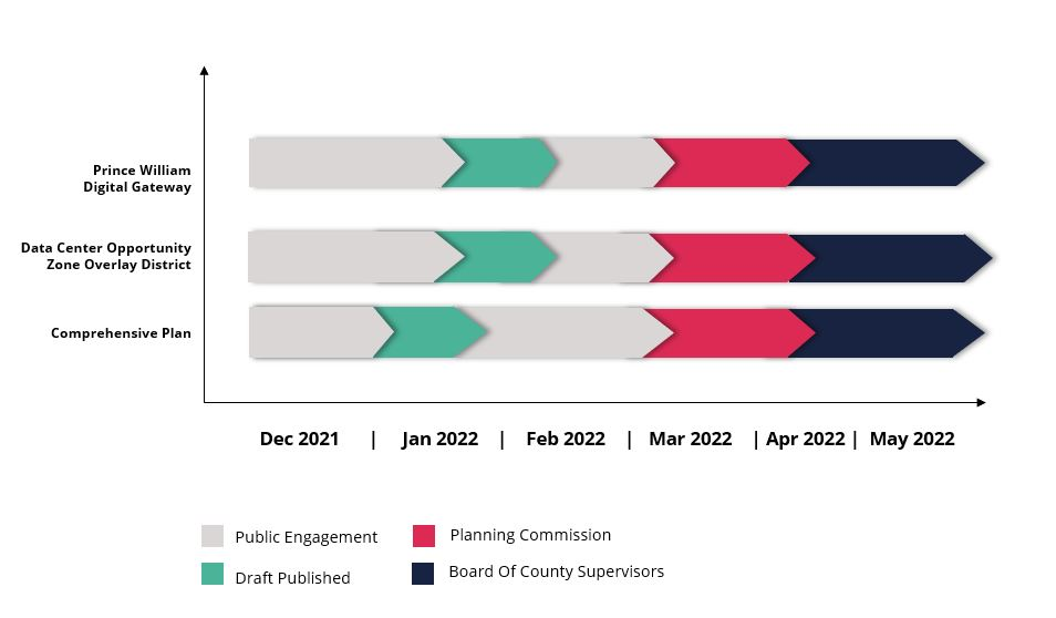
While relevant public hearing dates have not yet been set for the Planning Commission and Board of Supervisors, the County appears to be attempting to make three major land use decisions – the Prince William Digital Gateway, Data Center Overlay District expansion and comprehensive plan update – concurrently, rather than in a logical sequence. If the comprehensive plan is in fact the overarching document guiding the County’s growth, any decisions regarding the Digital Gateway or any other data center in need of a rezoning should be delayed until the comprehensive plan update is complete. Any proposal can be found to be consistent with, or justified by, a comprehensive plan that is being approved and developed at the same time it is brought forward. It is not too late for the County to engage in a well-thought-out comprehensive planning process that Prince William residents can have faith in.
Rather than engage in an authentic community planning process and meet its obligation to plan for growth that serves the interests of the broader public, the County is allowing data center developers and landowners who stand to make millions determine how the county should grow, despite having over 2,000 viable acres of land already allocated for data center construction.
The multi-pronged attack on the County’s Rural Area, natural environment, and quality of life that we’ve described here will not benefit the County into the future. Rather, it will put dollars into the wallets of speculative developers seeking to profit from development where land is cheap, while saddling taxpayers with the costs of extending infrastructure and diminishing water quality, national parks and traffic conditions. In the absence of sound land use planning or elected officials willing to back it, data center developers with deep pockets will continue to promise prices upward of $1 million per acre in rural areas to preserve their bottom line. The only thing that can stop data center sprawl from expanding further is Prince William residents saying “enough is enough.”
What You Can Do
To prevent more sprawl, traffic, and tax increases, and to preserve water quality, national parks, and quality of life for ALL residents of Prince William County, please:
- Write the Board of Supervisors and urge them to:
- Study the potential impacts these proposals will have on water resources so the County and its residents can understand the full costs of prioritizing data centers over clean drinking water for over 800,000 people.
- Engage in a transparent planning process that maintains public trust
- Vote NO to sprawling data center development in the rural areas of Prince William County.
- Vote NO to widening Pageland Lane and other construction projects linked to the Bi-County Parkway.
- Attend the Grow Smart PWC Coalition’s forum on June 2 at 7 p.m. at Jenkins Elementary School at 4060 Prince William Parkway, Woodbridge, VA 22192 to engage a growing coalition to protect water quality, historic resources and quality of life in the County. RSVP to attend.