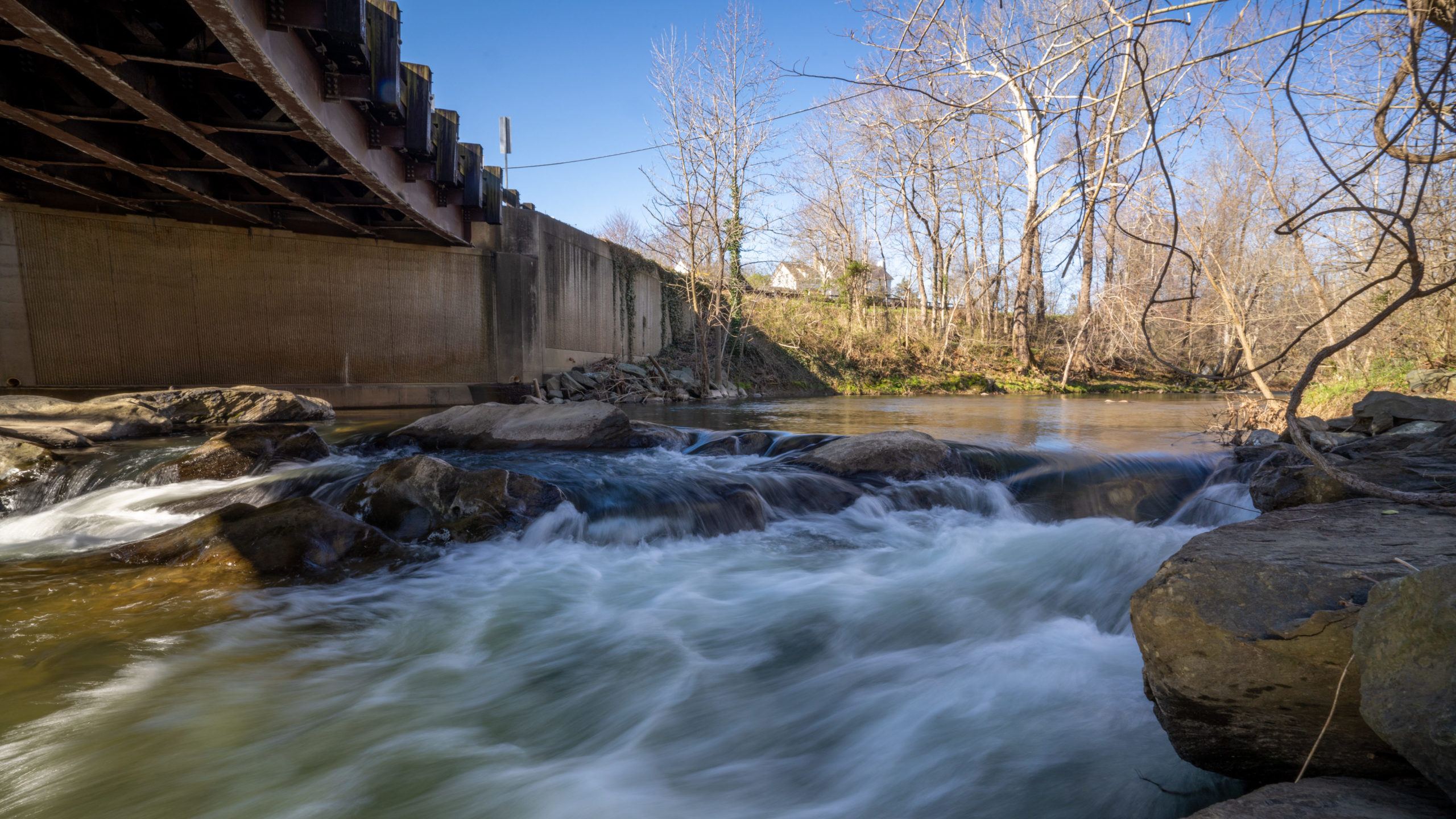
In western Albemarle County, the cold, pristine waters of the Moormans River spill over a towering Sugar Hollow Dam and wind eastward for 14.3 miles. Flowing gently at first through historic Sugar Hollow and White Hall, it gathers strength and speed from Doyles River, Wards Creek, and other streams before joining the Mechum River at Brinnington to form the Rivanna River. Eventually, the Moormans’ waters reach the James River and the Chesapeake Bay.
“The Moormans has always been a very special river. It has a rocky bottom, so it runs clear and hosts brook trout upstream. There are game corridors along the river. It has a lot of scenic value and is a unifying focus for the community. People love to fish, enjoy sitting on the rocks, and like to canoe it when the water is up,” said Sherry Buttrick, who for some 30 years owned property overlooking the Moormans at the Millington Bridge.
Back in the late 1980s, Buttrick and 27-year-old PEC staffer Kat Imhoff led an intensive, two-year, grassroots effort that culminated in 1988 with Virginia Scenic River designation for the Moormans, a nod to its superior natural and scenic beauty, fish and wildlife—including the endangered James spinymussel—and historic, recreational, geologic, and cultural features. A ceremonial ribbon cutting by then-supervisor Charlotte Humphris and a parade that included horses, dogs and a child on her tricycle marked the occasion.
Honoring the Moormans
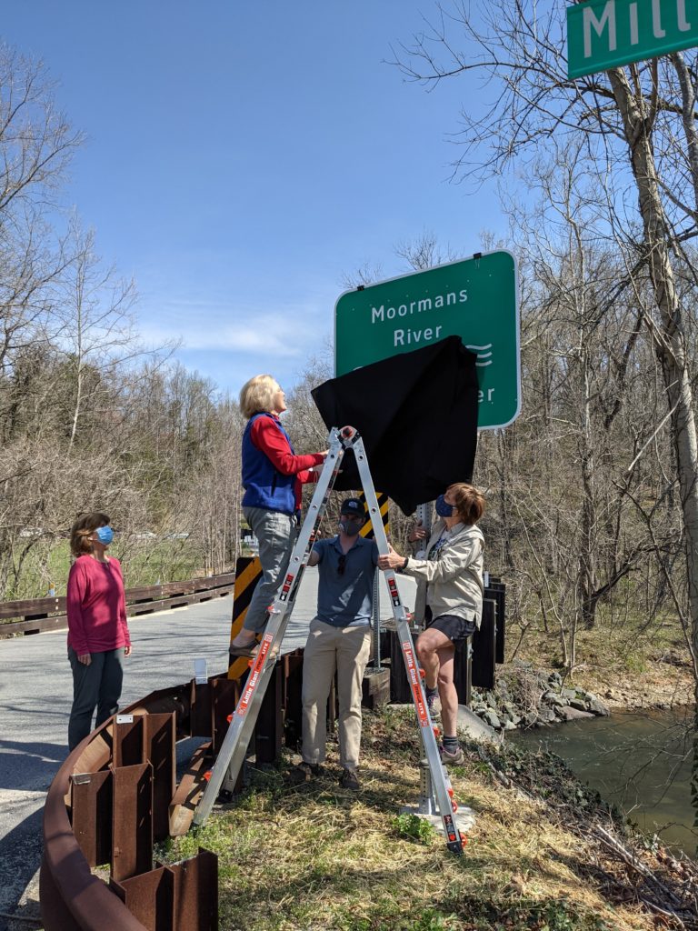
the new Moormans Scenic River sign at the Millington
Bridge, as PEC Senior Conservation Fellow Kat Imhoff
steadies the ladder and Supervisor Liz Palmer looks on. Credit: Cindy Sabato/PEC
Fast forward a little more than three decades to 2020—the 50th anniversary of Virginia’s Scenic Rivers Program. It was a year of pandemic, when more people than ever before sought out beautiful outdoor places like the Moormans for the healing and restorative powers of nature. Donna Bennet, a local resident and member of the informal advocacy group, Friends of the Moormans, said the added crowds took a big toll on the Moormans’ trails, riparian vegetation, and the river itself, sounding an alarm about the continuing need for strong stewardship. Discussing the problem, Bennett and Imhoff, now PEC’s senior conservation fellow, lamented that signs once proudly announcing the Moormans’ scenic river designation had long disappeared. Working with VDOT, a generous private donor, and locally-based Performance Signs, Imhoff made it a personal mission to replace them.
On April 5, 2021, with blue skies and warm sunshine above their heads and the rush of the Moormans below their feet, community members and local leaders joined with PEC staff on Millington Road bridge to unveil the first of six new signs. Though pandemic-related social distancing necessitated the crowd be small, the significance of the moment was palpable. Many folks in attendance called the banks of the Moormans home, others were part of its initial journey toward scenic river designation. Reporters from the Daily Progress and Crozet Gazette were there to document the event.
“It’s terribly important to us,” said PEC board member John Birdsall, who owns land along the Moormans. “I don’t live
on the Moormans anymore, but two of my daughters do, so I’m really happy to have the signs here. I think back to the late 80s when this designation was made and I thought it was a really good idea.
Standing high on an eight-foot ladder alongside Imhoff, preparing to pull the covering off the first sign, Albemarle Supervisor Ann Mallek said, “I’m glad we are making sure the people of today have an appreciation for the natural resources of the county. Listen to the song of this water. I stop and listen every time I can, because that’s what is connecting us to this wonderful environment.”
What’s Next for Albemarle’s Rivers and Streams?
The new signs are timely. With 59 percent of Albemarle’s streams and rivers found by the Virginia Department of Environmental Quality to be impaired by bacteria and other pollutants, Albemarle’s Comprehensive Plan has a strong focus on protecting and improving its water resources. The county in January 2021 kicked off a year-long public-engagement phase of its Stream Health Initiative, focused on the county’s rural area. This process will ultimately culminate in a community-developed set of recommendations to Albemarle’s Board of Supervisors at the end of the year.
“It’s a very collaborative process because landowners are 100 percent of the role. We need a lot of landowner buy-in and tools to help them complete projects improving their own properties,” Mallek said. PEC is advocating for the continued prioritization of land conservation, especially along waterways, as well as appropriate land uses, streamside buffer plantings, and reduction of hardened, impervious surfaces near streams, rivers and lakes.
Mallek said Friends of the Moormans has played a key role in elevating water quality issues for county leaders. The group was founded by Bennett and her husband Jim, along with Carroll and Bob Gilges in the 1990s, when the Rivanna Water and Sewer Authority (RWSA) began diverting every drop of water from the Moormans to feed Charlottesville’s water supply. Imhoff’s work on the scenic river signs has breathed renewed life into the group, which is now working to build support for the county’s Stream Health Initiative.
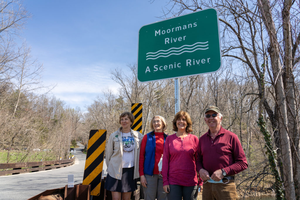
PEC Senior Conservation Fellow Kat Imhoff, Albemarle Supervisors Ann Mallek and Liz Palmer, and PEC board member John Birdsall. 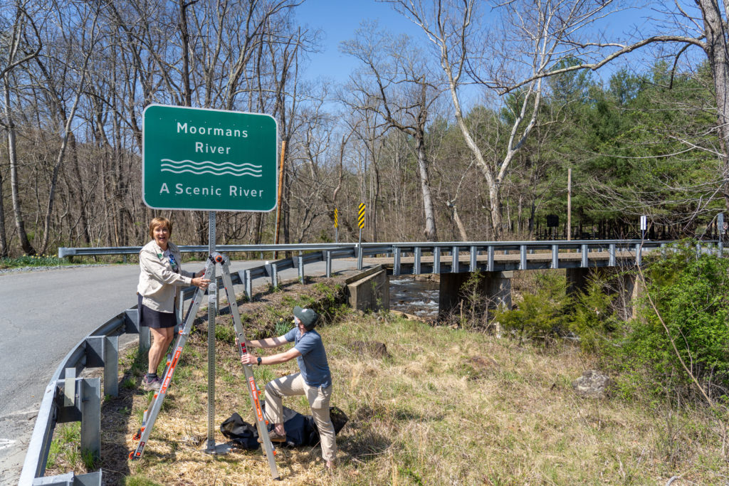
“Moormans River – A Scenic River.”
“As people are deconstructing nature to tidy up their world, we’ve been lobbying the county for more education about maintaining riparian buffers and about scenic river designation. One of our first steps is these new signs,” Bennett said. Friends of the Moormans is also working with Shenandoah National Park to improve parking near the reservoir to better protect surrounding natural areas and to install information kiosks at Moormans River trailheads.
“The inspiration that Friends of the Moormans has provided over the years, by constantly stirring the pot, has really encouraged local officials and local government. We would be nowhere without enthusiastic, engaged community members who are involved and passionate,” Mallek said.
Standing with Mallek on that ladder at the Millington Road bridge, Imhoff commended the county for “thinking a lot about the scenic resources of the county and why they matter. People forget what’s in their own backyard and lose track of those natural resources that are designated at a state level as important. The Moormans is a drinking water source for much of Charlottesville, so it’s a great reminder to think about the Moormans when you open your tap at home.”
Once the crowd and cameras dispersed that sunny spring day in April, Mallek and Imhoff headed off to uncover the remaining five signs along a winding Sugar Hollow Road as it criss-crossed the rapidly rushing water below: Moormans River — A Scenic River.