
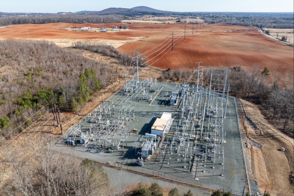
The Charlottesville-Gordonsville transmission line expansion project is directly driven by the 26 data center requests in Louisa and Culpeper counties that Dominion has received over the last five years.
Rob McGinnis
Greene County Summer Updates
Summer updates on PEC’s work on Greene County’s comprehensive plan, water supply planning and farmland protection.

Albemarle’s Budget Should Reflect its Promises
It’s budget season in Albemarle County. And you, residents of Albemarle County, have the ability to weigh in on what should be included in next year’s budget.
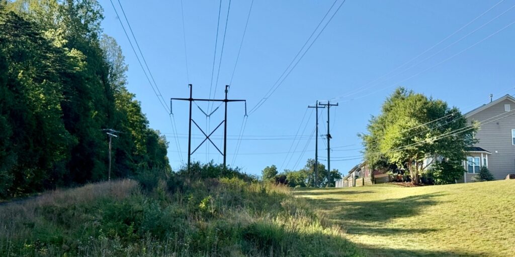
Two Transmission Lines to Run Through Albemarle and Charlottesville
Two transmission line infrastructure projects, proposed by Dominion Energy, could adversely impact the region’s cherished landscapes forever.

Tenaska Developer Continues to Push for Power Plant
Considering the known health and environmental impacts to the surrounding community (detailed below), we urge community members and the Planning Commission to vote no on granting the Special Use Permit and reject the Tenaska gas plant.
Significant Impacts of Tenaska’s Proposed Gas Power Plant
Despite the known health and environmental impacts to the surrounding community (detailed below), Tenaska has now proposed a second 1.5 gigawatt plant adjacent to the existing one.

Albemarle Comprehensive Plan Adopted!
After four years, 40 PEC action alerts, and many changes to the timeline, the Board of Supervisors adopted the Albemarle County Comprehensive Plan update (AC44) Wednesday, Oct. 15!

Albemarle Comprehensive Planto be Adopted Wed., Oct. 15
After four years of diligent work that included countless hours of community meetings, pop-ups, work sessions, surveys, and public hearings, this Wednesday, Oct. 15, the Board of Supervisors is expected to adopt the Albemarle County Comprehensive Plan.
Speak Up: Advocate for Responsible Regulation and Transparency in Albemarle’s Data Center Ordinance
This text was taken from an email alert sent out on August 1, 2025. Sign up for email alerts ➝
Dear Supporter,
Conversations about data center development have made their way steadily down PEC’s service region — from the “data center capital of the world” in Loudoun County to historic and environmentally significant sites in Culpeper and Orange counties, and now down to Albemarle County. PEC has been there every step of the way.
Last year, PEC and the Southern Environmental Law Center successfully advocated that larger data centers (those over 40,000 square feet) must go through the local legislative review process of a Special Use Permit, which requires opportunities for public feedback. Now, as the county further develops the existing Data Center Ordinance, PEC is focused on ensuring the county’s new ordinance includes responsible regulations and transparency to protect Albemarle County from potential adverse impacts from data centers.
Check out the impacts of data centers and the actions PEC is taking at the local and state level on our data center landing page, and learn more about Albemarle County’s data center ordinance on the county’s webpage. Let’s advocate together.
Data Center Impacts
The impacts of explosive data center development include increased utility rates for all consumers, new massive transmission lines and substations, impaired air quality, threats to local water supply, and Virginia’s pending failure to meet our hard-fought climate goals by continuing to rely on energy generated using fossil fuels.
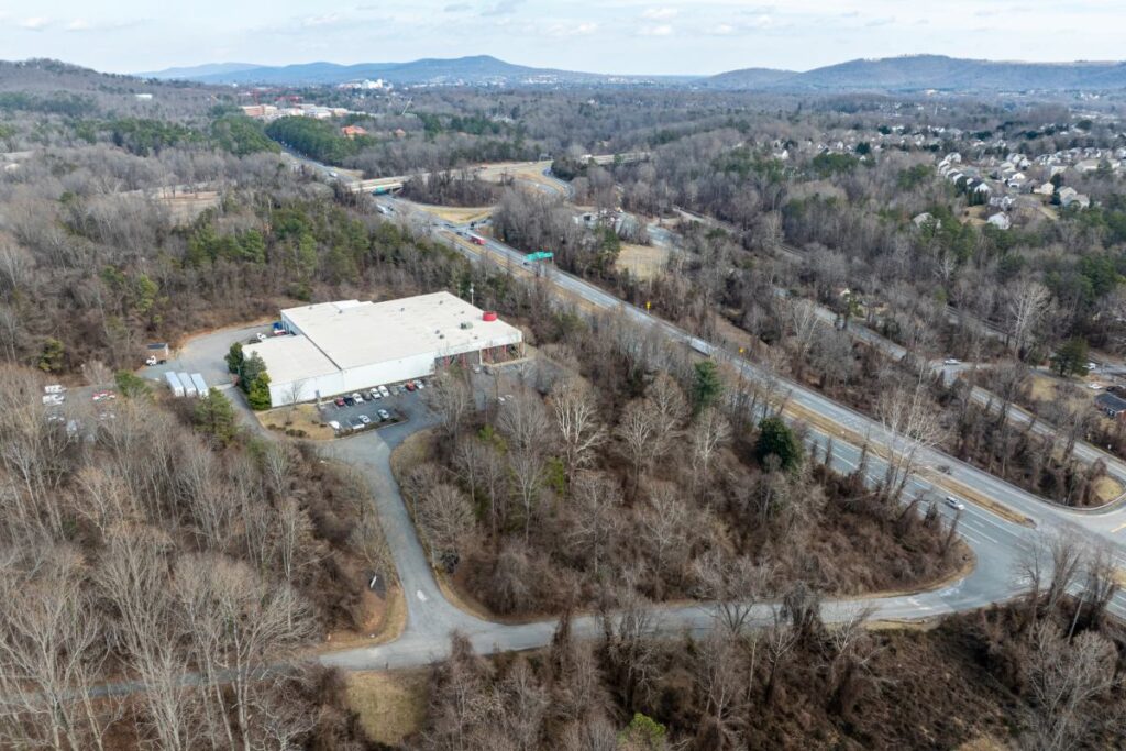
Locally, the potential for noise pollution, visual obtrusion and diesel generator-caused air pollution of large data centers near parks, neighborhoods and medical facilities are reasons enough to ensure that community members have the ability to voice their concerns through a Special Use Permit when data center proposals are introduced in the future.
What’s in the Proposed Data Center Ordinance
To protect our communities from the impacts of massive data centers, those larger than 40,000 square feet should be required to go through a Special Use Permitting process, even in Industrial Districts. In their data center ordinance, the county is proposing rules that would allow much larger data centers to be built by-right, without public input.
We are especially concerned that Albemarle County is proposing:
- Data Center Overlay Districts in Light Industrial-zoned parcels in the Development Areas. Within these districts, data centers as large as 500,000 square feet could be built by-right. Data centers larger than those upper limits would require Special Use Permits.
- Data centers located with the Data Center Overlay Districts will be classified with two size tiers to reflect the relative sensitivity of exisitng land uses to data centers and their impacts:
- Tier 1: 125,000 square feet, or about two football fields
- Tier 2: 500,000 square feet, or over eight football fields; by-right Tier 2 data centers could be as large as the entire square footage of the Fifth Street Station shopping center
- Preliminary county-identified potential Data Center Overlay District locations include: alongside U.S. Route 29 North at Rivanna Futures and the Emerson campus; in the North Fork Industrial Park near the airport; behind Martha Jefferson Hospital on Pantops; near Heyward Community Forest at the I-64 and U.S. Route 29 interchange; and along Avon Street north of I-64.
- Data centers can still be built outside of these overlay districts through a Special Use Permit process so the public will have a chance to voice their concerns.
Additional Concerns:
- Impacts of water use, including the county’s proposed requirement for cooling through re-use of water and closed-loop systems
- The potential inadequacy of the county’s noise ordinance to address the unique noise generation of data centers
- Threats to public health associated with the operation of large numbers of diesel and gas generators, particularly during power outages
Take Action
Tell the Board of Supervisors that all proposed data centers larger than 40,000 square feet within industrial districts, should go through a Special Use Permit process.
By proposing Data Center Overlay Districts, where very large data centers would be by-right development with no opportunity for public comment and no review by Planning Commissioners and the Board of Supervisors, the county seems to be deliberately attracting data center development and failing to protect the public interest.
Given the very real potential adverse impacts of data centers and the rapidly evolving technologies, building design, and data center operations, the county should prioritize protection of public health, safety, and welfare with this new Data Center Ordinance by requiring all data centers larger than 40,000 square feet in industrial districts to go through a Special Use Permit process.
- Email your comments by Aug. 5: Email your comments to the Board of Supervisors and the Planning Commission at [email protected] and [email protected] with the subject line “For Responsible Regulation and Transparency in Albemarle’s Data Center Ordinance.”
- Attend the Aug. 6 Work Session: Showing elected and county officials that their citizens are paying attention to the decisions that impact them is significant. Tell your friends and family what you heard after the work session.
- Submit questions to county staff: The public can submit questions on the data center ordinance landing page that will be answered publicly by county staff.
- Learn more about the Draft Ordinance: The public will be able to speak at the Planning Commission’s Public Hearing Sept. 23 and the Board of Supervisors’ Public Hearing on Nov. 19. Stay tuned for a PEC community meeting and talking points from us.
Thank you!
Rob McGinnis, PLA FASLA
Senior Land Use Field Representative
Albemarle & Greene Counties
[email protected]
(434) 962-9110 ext. 7049
Related News Coverage: July 31, 2025: 29 News: Albemarle County grapples with proposed data center regulation

Albemarle’s Growth Management Policy at Inflection Point
Expanding the Development Areas now is not only unnecessary, but would compromise the county’s climate and resiliency goals.