The Piedmont Environmental Council is working with community members in Albemarle County to research and document the history and associated historic resources of African American communities in and around the Southwest Mountains.
Background on the Southwest Mountains Rural Historic District
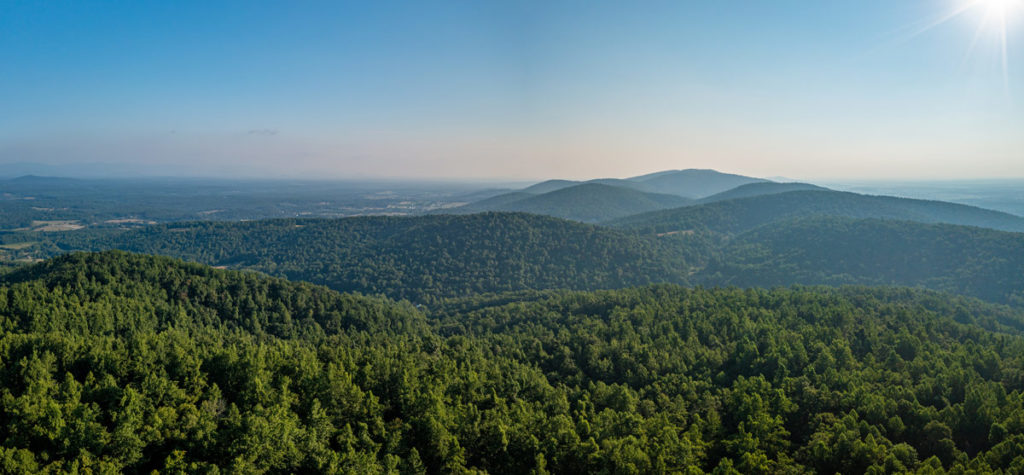
The Southwest Mountains Rural Historic District encompasses a 31,000-acre area that extends from the Orange County line almost to the City of Charlottesville. The district is characterized by pastures, roadways, forested areas and small villages in between, which reflect thousands of years of land use and settlement patterns. A multitude of historic estates, such as Castle Hill, Cloverfields, and Maxfield Farm, coupled with postbellum buildings including Keswick Hunt Club and turn-of-the-century country stores at Lindsey and Cobham, exemplify the broad variety of architectural styles, ranging from mid-18th century Georgian and mid-19th century Greek Revival mansions to early 20th-century vernacular structures.
PEC led the effort to nominate the district, which was officially listed on the National Register of Historic Places in 1992.
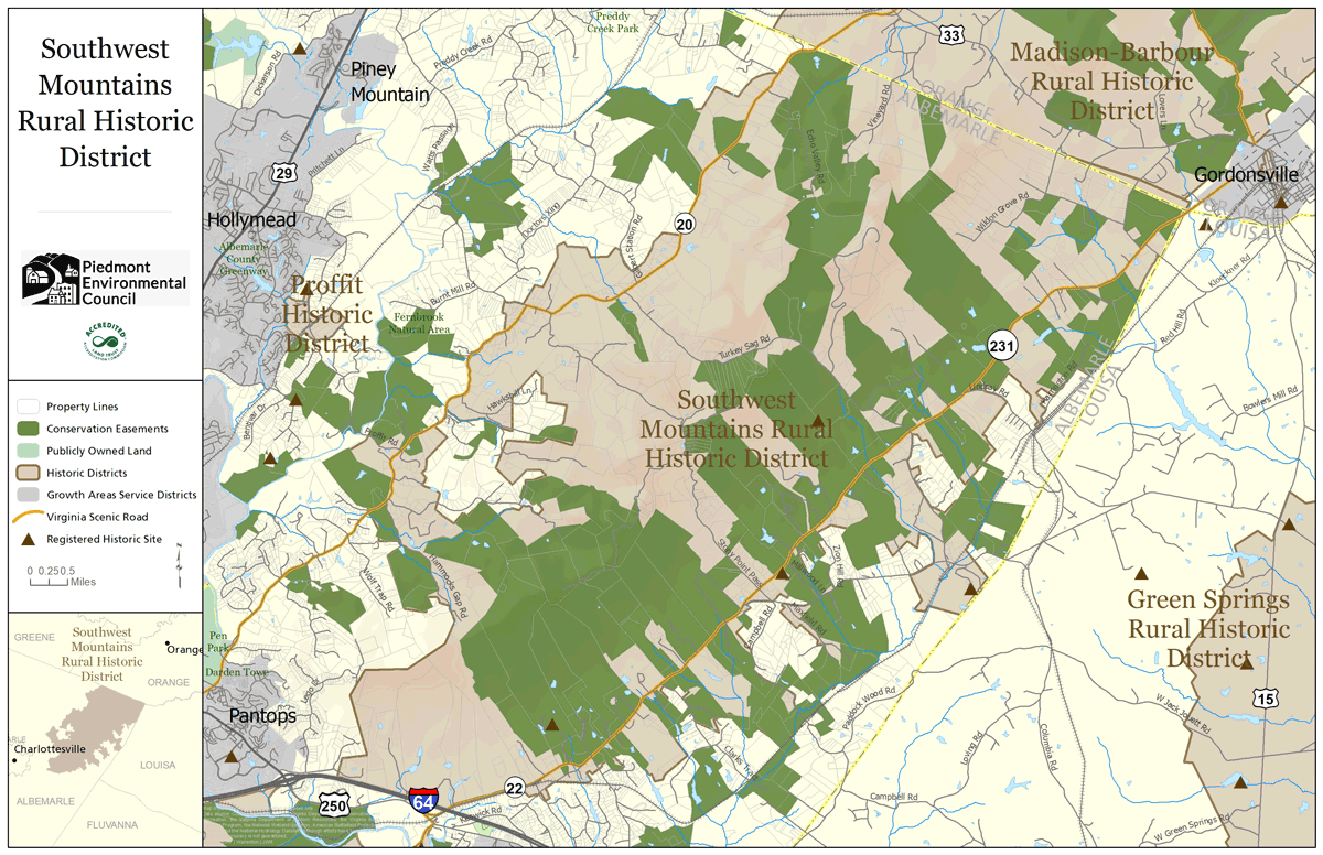
Despite the establishment of a number of large African American communities around the Southwest Mountains after Emancipation, the present district largely ignores these communities, their residents and their legacy. Many historically African American communities within the Southwest Mountains, such as Scuffletown, Cismont, and Cobham, lie in close proximity to former plantation houses in the region and, built around churches and schools, exemplify settlement patterns consistent with postbellum Black neighborhoods.
Webmap: African American Historic Land Ownership
Research Paper: Blurred Lines: African American Community, Memory, and Preservation in the Southwest Mountains Rural Historic District

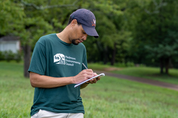
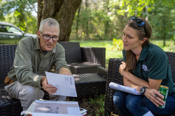
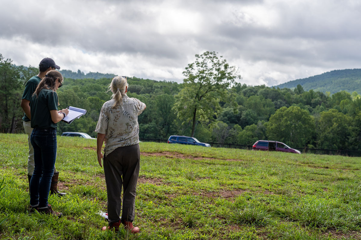
PEC’s Damien Sharp documenting a visit to a property in the Southwest Mountains Rural Historic District. Credit Hugh Kenny/PEC. PEC’s Kristie Kendall talking to a landowner about his property in the Southwest Mountains Rural Historic District. Credit Hugh Kenny/PEC.
Of the nearly 1,000 historic resources identified as contributing to the Southwest Mountains Rural Historic District, less than one percent explicitly recognizes the rich history and legacy of African American contributions.
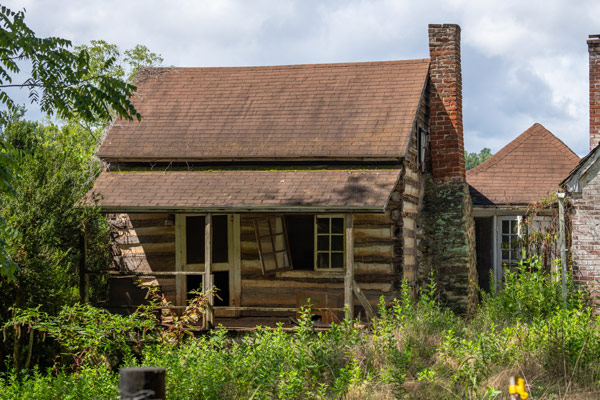
Enslaved Africans and African Americans were largely responsible for the construction of the built environment of the Southwest Mountains area prior to emancipation. Their legacy can be seen in large plantation homes, extant outbuildings like smokehouses, springhouses, barns and enslaved dwellings, which date prior to the mid-19th century. In the years that followed emancipation, many freetowns flourished with residences, churches, schools, fraternal organizations and businesses. Whether they still stand today or exist as archaeological sites, these resources need to be identified, documented and recognized for their import.
In order to honor the centuries of contributions by Black Virginians in this area, PEC’s work will include the following:
- Researching chains of title and mapping African American communities throughout the Southwest Mountains area, including the following communities: Scuffletown, Cobham, Clarks Tract Road, Bunker Hill, Boyden and Lindsay.
- Conducting community outreach with local stakeholders.
- Working with the Virginia Department of Historic Resources to develop and install a historic roadside marker that recognizes the legacy of African Americans in the district (planned for 2023).
- Documenting extant historic resources in these communities, including houses, churches, schools, businesses and cemeteries.
Our hope is that this work will help these historic African American communities determine how they want the historic sites within their communities to be recognized in the future, whether part of the existing district or independently.
This research could inform future updates to the Southwest Mountains Rural Historic District nomination. Future work on the Southwest Mountains Rural Historic District would also need to include a more complete history of Native peoples in the area, during a period stretching back nearly 15,000 years. By the Late Woodland period (roughly, 1,000 years ago), the people living in this area had organized into the Monacan Confederacy, a group of related Siouan-speaking tribes including the Saponis, Tutelos, and Monacans. One of the Monacan villages, known as Monasukapanough was located on the Rivanna River near the western end of the historic district, close to the city of Charlottesville. Revisions to the district need to include a contextual history through the period of contact with European settlers, as well as associated archaeological sites inventoried in the area since the district’s listing on the National Register of Historic Places.
Freetowns
This series of maps is the result of PEC’s title history research. There is one map for each of the six Freetowns that this project covers, showing the original parcels of land that made up the communities. The parcels are numbered and labeled according to the date they were first purchased by an African American and that original landowner’s name. They show how the communities developed after Emancipation and grew over time as more African Americans purchased land adjacent to other Black landowners, resulting in a number of thriving communities of Freedmen and their descendants in the Southwest Mountains region. Hover over the map below for right and left arrows that you can use to click through the maps, or view all the full-size maps on Flickr.

Project Goals
- Document the history of the historically Black communities in and around the Southwest Mountains in order to acknowledge and honor their contributions and legacy.
- Analyze the extent to which historic resources in these communities still exist through documentation of exteriors of buildings, structures and any other above-ground resources.
- Determine whether these communities are eligible for the National Register of Historic Places.
What Has Been Completed So Far?
- Most of the title history research and mapping for the communities, which are available on PEC’s public webmap dedicated to African American land ownership.
- PEC staff has had regular calls and meetings with community stakeholders to gather local insight into the region and ground its research findings in order to provide context for the history of the communities in this area.
- PEC has sent mailers to all landowners within the historically African American communities that included a map and information regarding the project.
What’s Happening Now?
- PEC is scheduling visits to document historic buildings and sites.
- PEC is meeting with descendants and community members.
- PEC is working with the UVA History Department to complete oral histories and document historic resources in these communities.
What’s Next?
- PEC staff plans to continue community meetings and tabling opportunities throughout 2022-2023.
How Can I Get Involved?
- Email Amelia Hughes, PEC’s Preservation Outreach Representative for Albemarle County, at [email protected].
- Let us know if you own property in one of the historic communities we are documenting through this project.
Throughout its history, PEC has worked to create historic districts across its nine-county service area in an effort to bring communities together to think about the long-term protection of their unique cultural and historic assets. Learn more about historic districts >>