As part of PEC’s mission to protect historic resources, we have been working on the ground with communities throughout our nine-county region to document historic parcels from the 1800s through today, including those relevant to African American land ownership.
This documentation can be found in a new ArcGIS map, which will be updated as we continue our research. The map is primarily intended for use by historians but is openly accessible to anyone with an interest in the documentation (see How to Use the Map and Glossary of Terms below for more information). View the interactive map online >>
Why Is This Documentation Important?
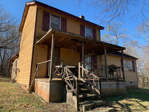
All across Virginia in the years following the Civil War, Black men and women exercised their freedom in large numbers by purchasing land and building their own homes, educating themselves in schools, and worshipping in churches they organized themselves. Many of these communities, which grew up around clusters of houses, a school and church, flourished to include fraternal organizations, restaurants, general stores, blacksmiths, and other Black-owned businesses. These communities were and still are, powerful reminders of the agency and determination of the African American community to create opportunities for themselves, especially amidst the background of fear and oppression during the Jim Crow era.
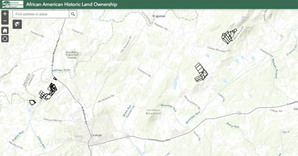
While historically Black communities across rural Virginia once numbered in the thousands, many of them have been lost over time as residents moved away in search of more opportunities. PEC has begun mapping these communities across its region by documenting the original parcels acquired by African Americans and compiling them into a map, so the growth of these communities can be visualized. For example, in the Orange County community of Little Petersburg, we mapped the acquisition of parcels by decade, so you can click on 1870, 1880, 1890, and so forth, to see how the community evolved over time. This deed map can be overlaid with current parcel data to learn more about historic buildings that may still stand in a particular community. Many of the parcels in these communities were purchased by formerly enslaved people. This project serves as a record of their legacy.
If you have more information to share about the people associated with founding these communities and/or historic parcels, please contact Historic Preservation Coordinator Kristie Kendall at [email protected] or call (540) 347-2334 ext. 7061.
How to Use the Map
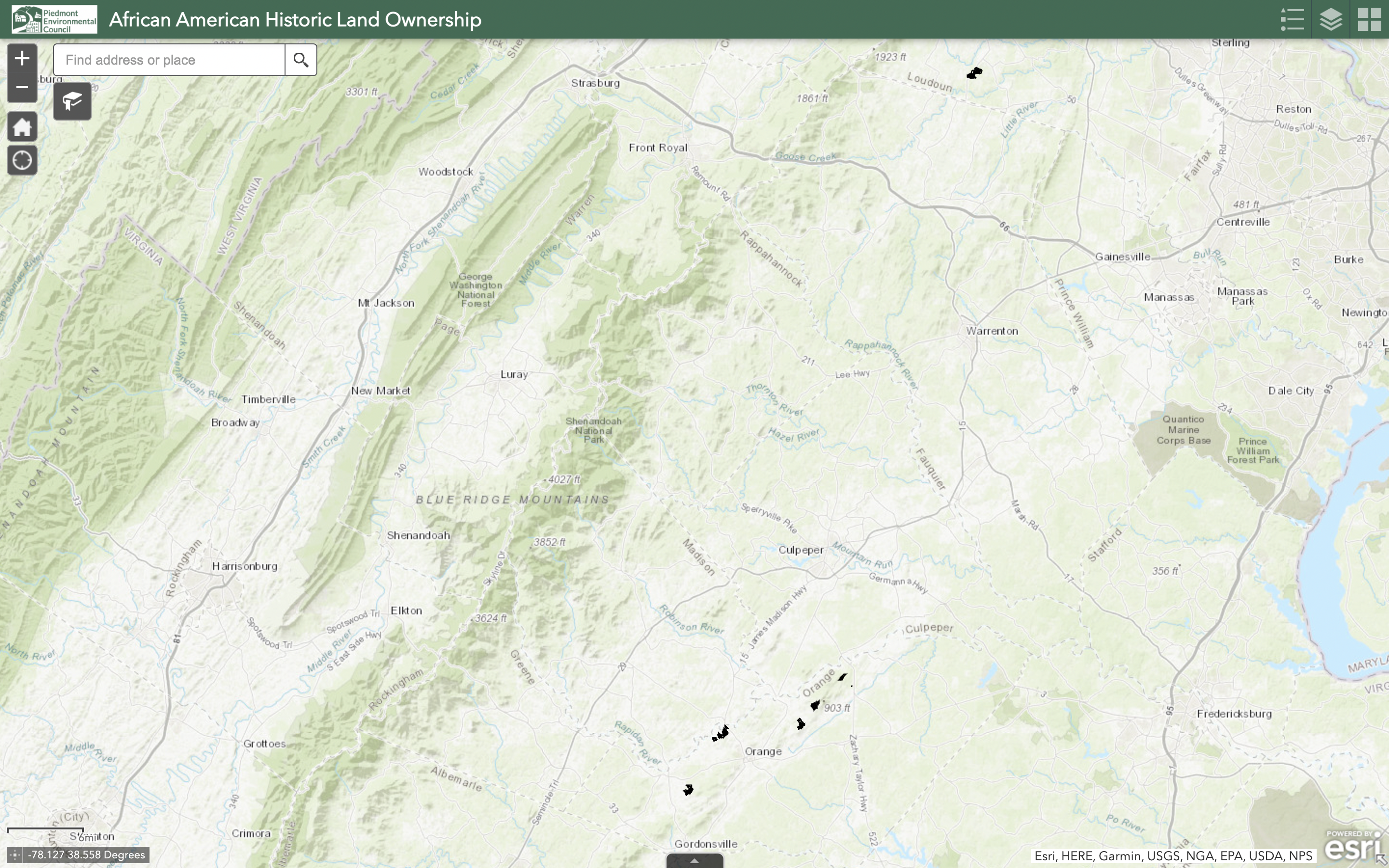
1. Open up the map. Use the white search bar at the top left of the map to find a specific address or county.
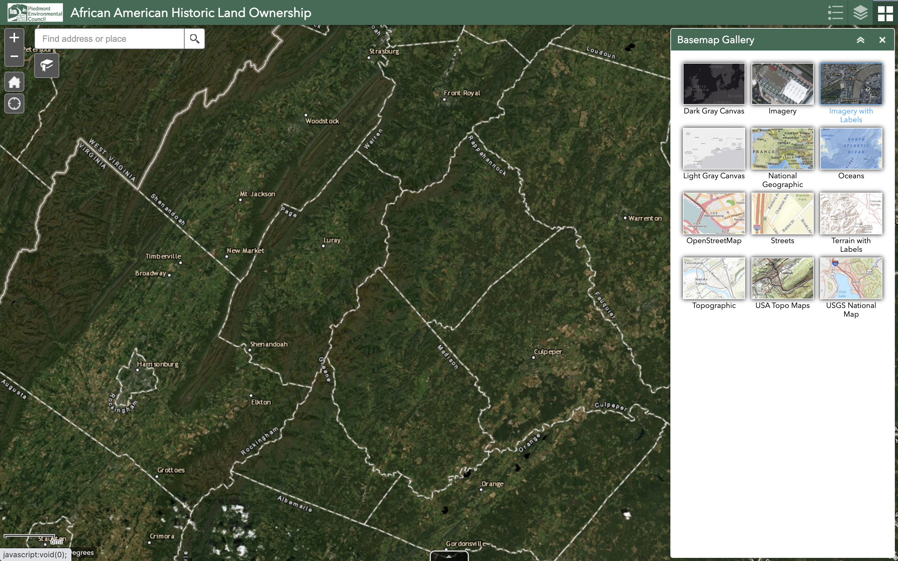
2. To view a different basemap, such as aerial imagery or terrain, click Basemap Gallery in the top right corner (middle button on the green header). Selecting “Imagery with Labels” will show a similar view as you might have in Google Maps.
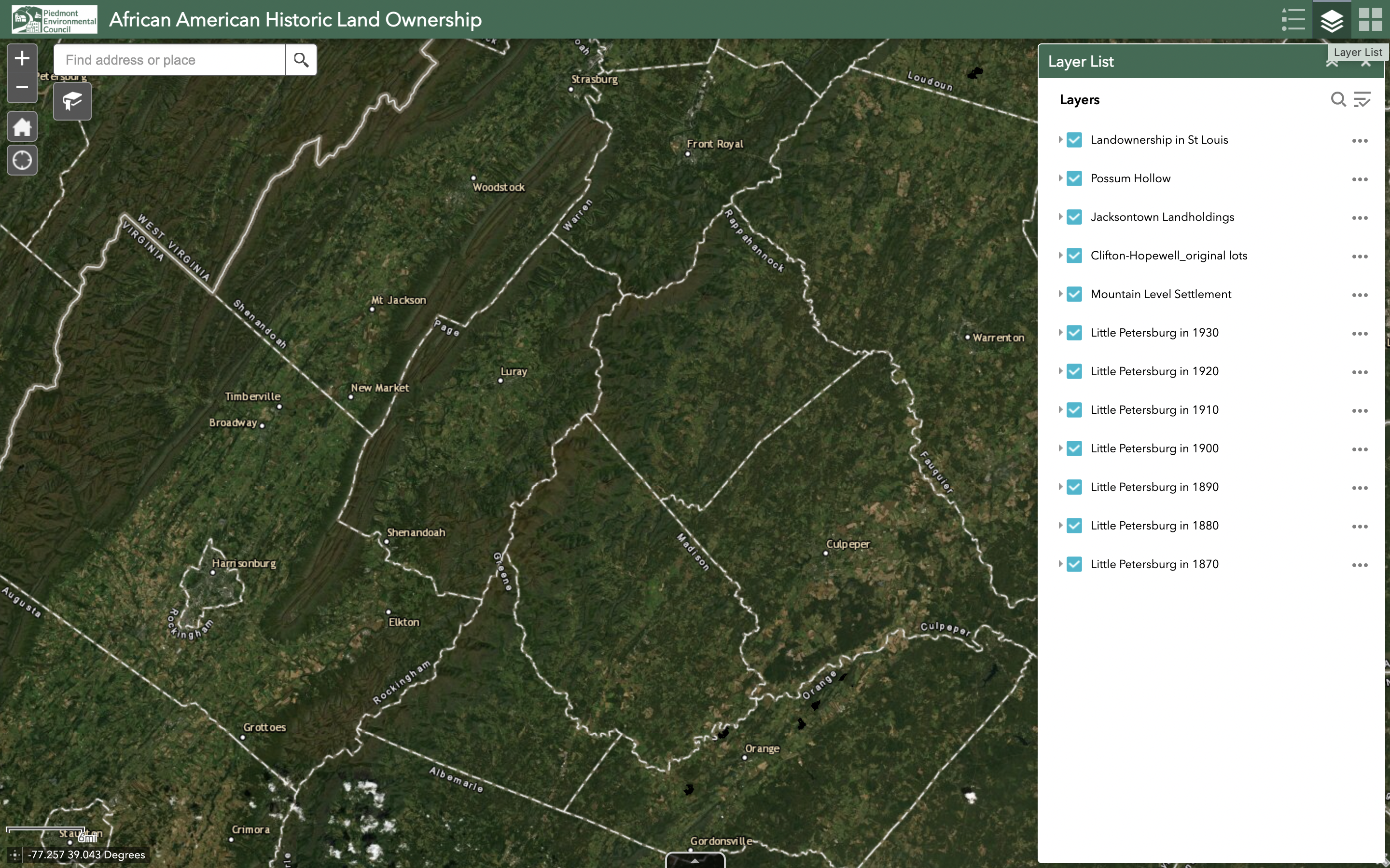
3. To access each data, click Layer List in the top right corner (middle button on the green header).
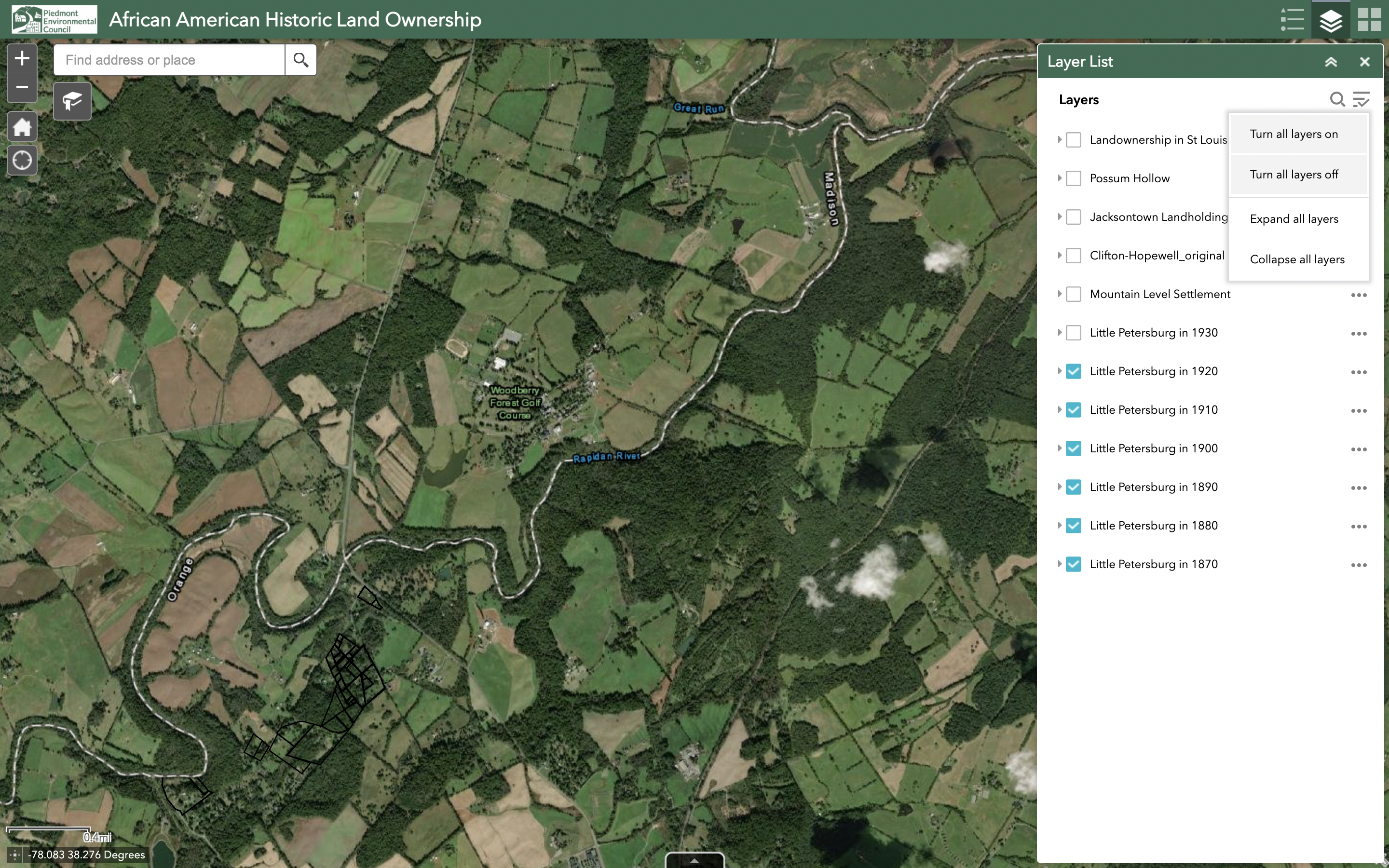
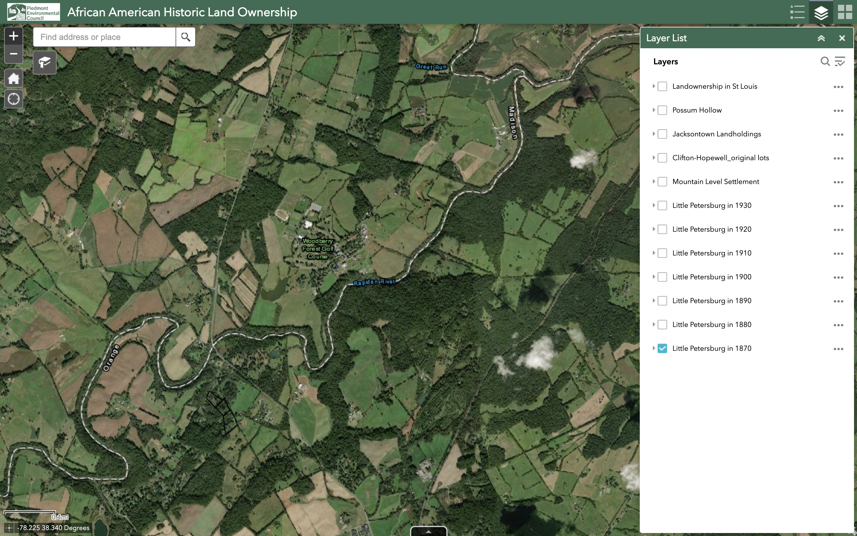
4. On the drop-down menu, you can click each data layer on and off with the blue checkboxes, or click the button in the top right corner of the same menu for options to select or deselect all layers. For example, you can “turn all layers off”, then click each Little Petersburg layer with the blue boxes one by one from 1870 to 1930 to see the progression in parcel ownership.
5. To zoom in or out, use the gray ‘+’ and ‘-‘ buttons in the top left corner of the map. You can click-and-drag on the map directly with the cursor to navigate.
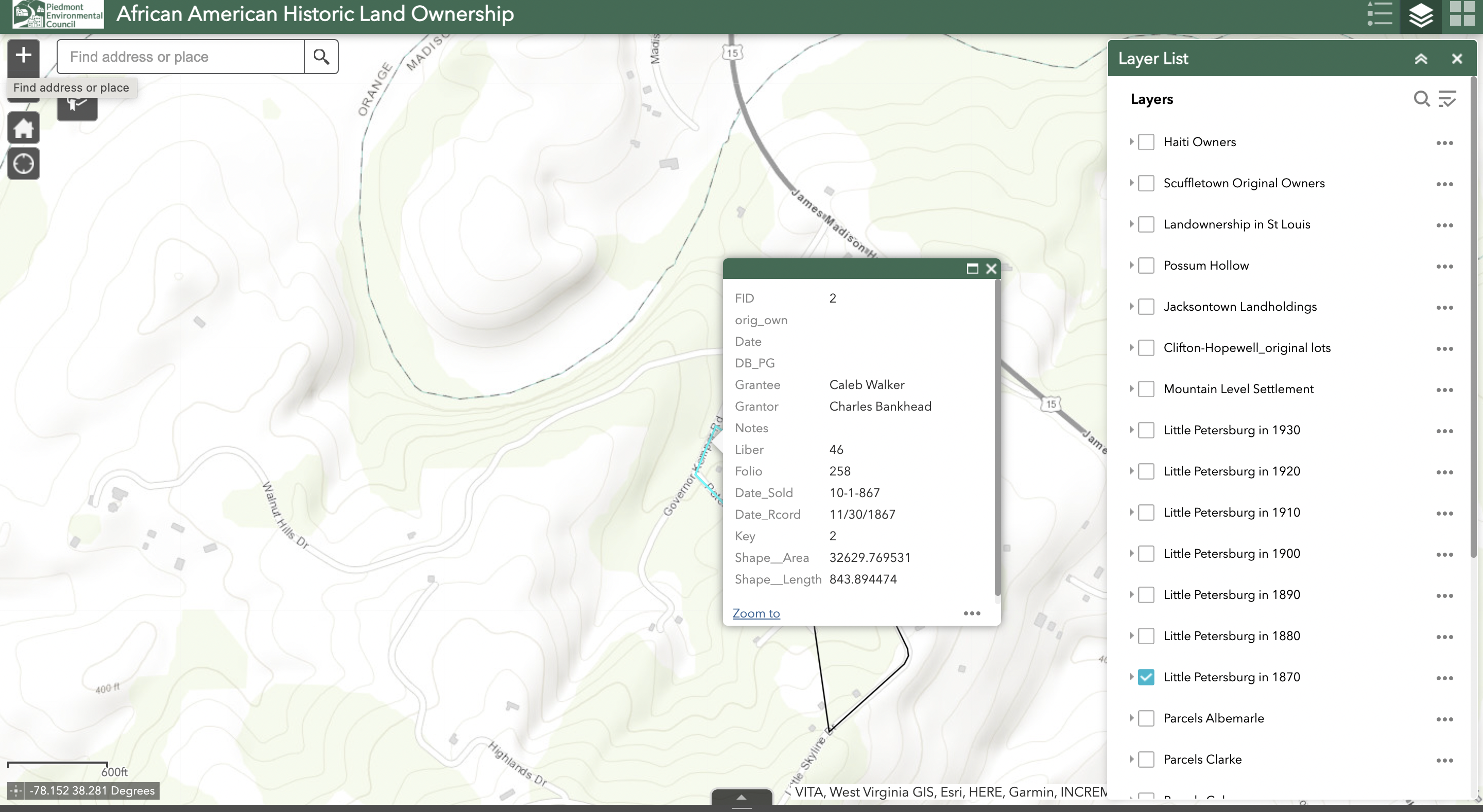
6. Click on a parcel layer to find out more information. A pop-up menu will appear – use the Glossary of Terms below to navigate the information. You can also use the three dots next to each parcel layer on the Layer List to see more options.

7. To see how the historic parcels overlap with current property boundaries, you can turn on both the historic parcel data and the parcel data for whatever county you are investigating.
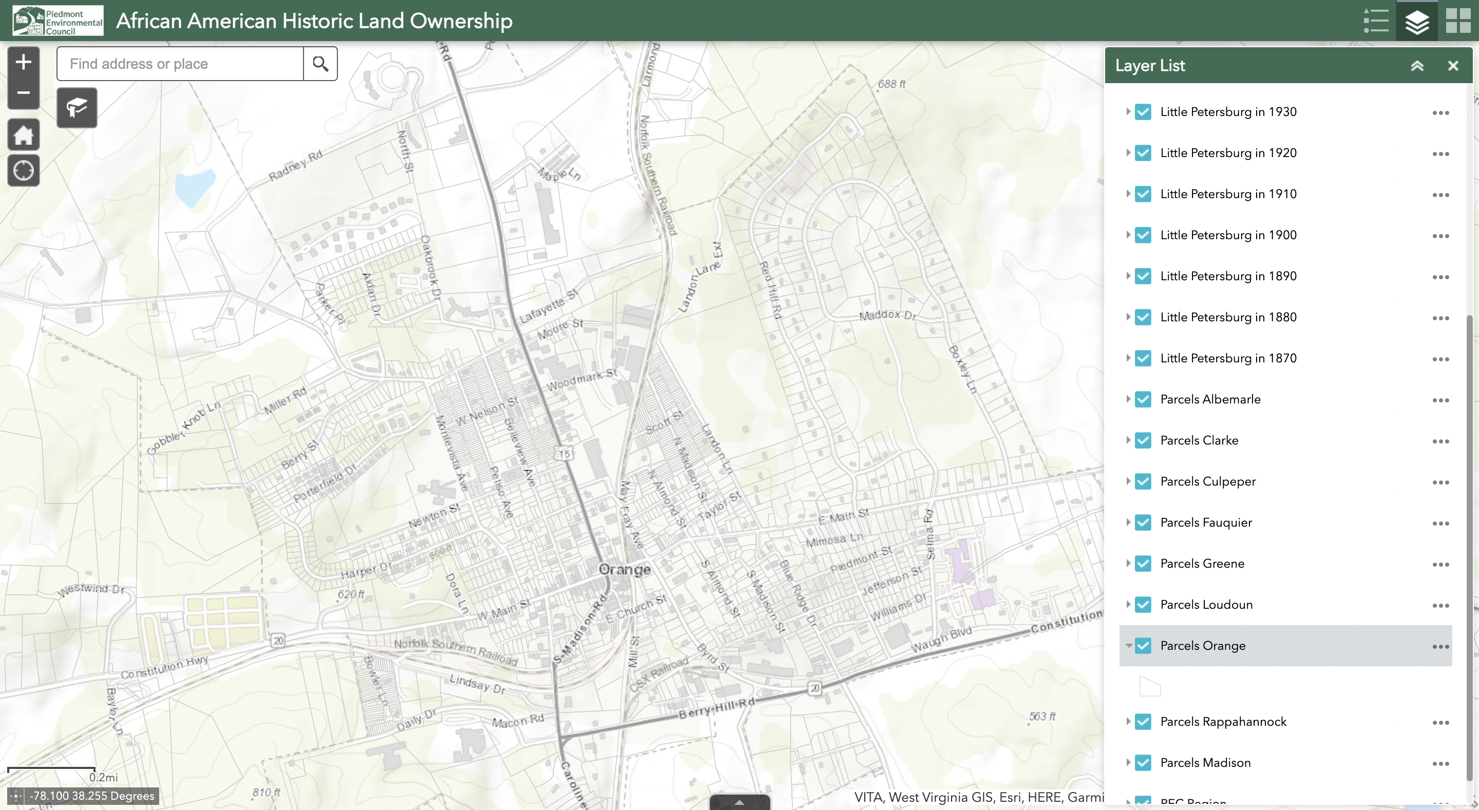
8. For example, this is the map with current parcels in Orange County selected.
Glossary of Terms
Grantee – Purchaser
Grantor – Seller
Liber – Deed Book
Folio – Page Number
Date_sold – When the purchaser acquired the land
Date_rcord – When the deed was recorded in the land books in the courthouse