
It’s budget season in Albemarle County. And you, residents of Albemarle County, have the ability to weigh in on what should be included in next year’s budget.
Rob McGinnis
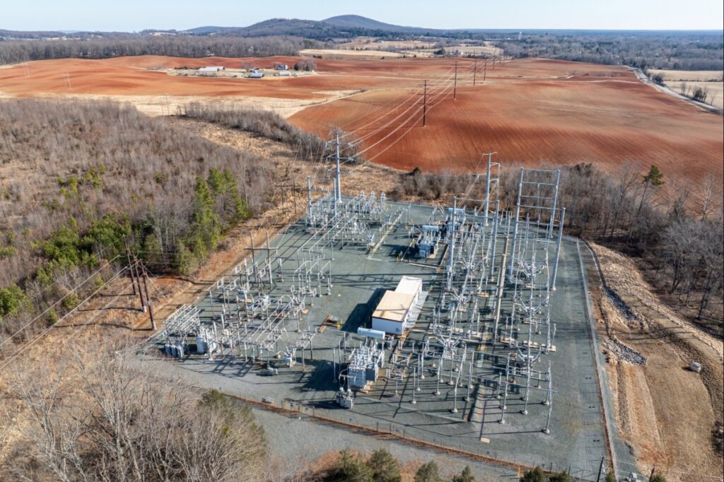
Two Transmission Lines to Run Through Albemarle and Charlottesville
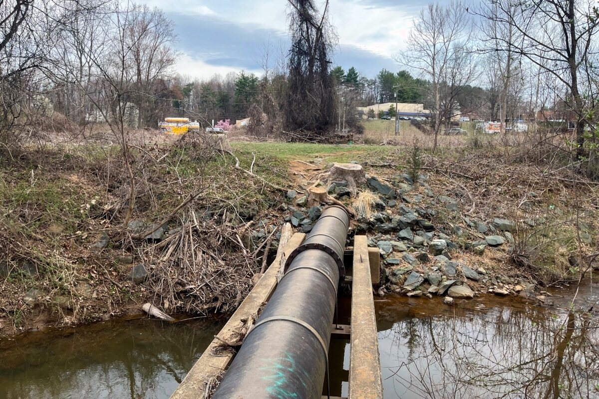
Two transmission line infrastructure projects, proposed by Dominion Energy, could adversely impact the region’s cherished landscapes forever.

Tenaska Developer Continues to Push for Power Plant
Considering the known health and environmental impacts to the surrounding community (detailed below), we urge community members and the Planning Commission to vote no on granting the Special Use Permit and reject the Tenaska gas plant.
Significant Impacts of Tenaska’s Proposed Gas Power Plant
Despite the known health and environmental impacts to the surrounding community (detailed below), Tenaska has now proposed a second 1.5 gigawatt plant adjacent to the existing one.

Albemarle Comprehensive Plan Adopted!
After four years, 40 PEC action alerts, and many changes to the timeline, the Board of Supervisors adopted the Albemarle County Comprehensive Plan update (AC44) Wednesday, Oct. 15!

Albemarle Comprehensive Planto be Adopted Wed., Oct. 15
After four years of diligent work that included countless hours of community meetings, pop-ups, work sessions, surveys, and public hearings, this Wednesday, Oct. 15, the Board of Supervisors is expected to adopt the Albemarle County Comprehensive Plan.
Speak Up: Advocate for Responsible Regulation and Transparency in Albemarle’s Data Center Ordinance
This text was taken from an email alert sent out on August 1, 2025. Sign up for email alerts ➝
Dear Supporter,
Conversations about data center development have made their way steadily down PEC’s service region — from the “data center capital of the world” in Loudoun County to historic and environmentally significant sites in Culpeper and Orange counties, and now down to Albemarle County. PEC has been there every step of the way.
Last year, PEC and the Southern Environmental Law Center successfully advocated that larger data centers (those over 40,000 square feet) must go through the local legislative review process of a Special Use Permit, which requires opportunities for public feedback. Now, as the county further develops the existing Data Center Ordinance, PEC is focused on ensuring the county’s new ordinance includes responsible regulations and transparency to protect Albemarle County from potential adverse impacts from data centers.
Check out the impacts of data centers and the actions PEC is taking at the local and state level on our data center landing page, and learn more about Albemarle County’s data center ordinance on the county’s webpage. Let’s advocate together.
Data Center Impacts
The impacts of explosive data center development include increased utility rates for all consumers, new massive transmission lines and substations, impaired air quality, threats to local water supply, and Virginia’s pending failure to meet our hard-fought climate goals by continuing to rely on energy generated using fossil fuels.
Locally, the potential for noise pollution, visual obtrusion and diesel generator-caused air pollution of large data centers near parks, neighborhoods and medical facilities are reasons enough to ensure that community members have the ability to voice their concerns through a Special Use Permit when data center proposals are introduced in the future.
What’s in the Proposed Data Center Ordinance
To protect our communities from the impacts of massive data centers, those larger than 40,000 square feet should be required to go through a Special Use Permitting process, even in Industrial Districts. In their data center ordinance, the county is proposing rules that would allow much larger data centers to be built by-right, without public input.
We are especially concerned that Albemarle County is proposing:
- Data Center Overlay Districts in Light Industrial-zoned parcels in the Development Areas. Within these districts, data centers as large as 500,000 square feet could be built by-right. Data centers larger than those upper limits would require Special Use Permits.
- Data centers located with the Data Center Overlay Districts will be classified with two size tiers to reflect the relative sensitivity of exisitng land uses to data centers and their impacts:
- Tier 1: 125,000 square feet, or about two football fields
- Tier 2: 500,000 square feet, or over eight football fields; by-right Tier 2 data centers could be as large as the entire square footage of the Fifth Street Station shopping center
- Preliminary county-identified potential Data Center Overlay District locations include: alongside U.S. Route 29 North at Rivanna Futures and the Emerson campus; in the North Fork Industrial Park near the airport; behind Martha Jefferson Hospital on Pantops; near Heyward Community Forest at the I-64 and U.S. Route 29 interchange; and along Avon Street north of I-64.
- Data centers can still be built outside of these overlay districts through a Special Use Permit process so the public will have a chance to voice their concerns.
Additional Concerns:
- Impacts of water use, including the county’s proposed requirement for cooling through re-use of water and closed-loop systems
- The potential inadequacy of the county’s noise ordinance to address the unique noise generation of data centers
- Threats to public health associated with the operation of large numbers of diesel and gas generators, particularly during power outages
Take Action
Tell the Board of Supervisors that all proposed data centers larger than 40,000 square feet within industrial districts, should go through a Special Use Permit process.
By proposing Data Center Overlay Districts, where very large data centers would be by-right development with no opportunity for public comment and no review by Planning Commissioners and the Board of Supervisors, the county seems to be deliberately attracting data center development and failing to protect the public interest.
Given the very real potential adverse impacts of data centers and the rapidly evolving technologies, building design, and data center operations, the county should prioritize protection of public health, safety, and welfare with this new Data Center Ordinance by requiring all data centers larger than 40,000 square feet in industrial districts to go through a Special Use Permit process.
- Email your comments by Aug. 5: Email your comments to the Board of Supervisors and the Planning Commission at [email protected] and [email protected] with the subject line “For Responsible Regulation and Transparency in Albemarle’s Data Center Ordinance.”
- Attend the Aug. 6 Work Session: Showing elected and county officials that their citizens are paying attention to the decisions that impact them is significant. Tell your friends and family what you heard after the work session.
- Submit questions to county staff: The public can submit questions on the data center ordinance landing page that will be answered publicly by county staff.
- Learn more about the Draft Ordinance: The public will be able to speak at the Planning Commission’s Public Hearing Sept. 23 and the Board of Supervisors’ Public Hearing on Nov. 19. Stay tuned for a PEC community meeting and talking points from us.
Thank you!
Rob McGinnis, PLA FASLA
Senior Land Use Field Representative
Albemarle & Greene Counties
[email protected]
(434) 962-9110 ext. 7049
Related News Coverage: July 31, 2025: 29 News: Albemarle County grapples with proposed data center regulation

Albemarle’s Growth Management Policy at Inflection Point
Expanding the Development Areas now is not only unnecessary, but would compromise the county’s climate and resiliency goals.

U.S. Route 29 Slated to Become an “Innovation Corridor”
This text was taken from an email alert sent out on May 15, 2025. Sign up for email alerts →
Dear Supporter,
U.S. Route 29 is the primary gateway into Albemarle County and Charlottesville, a Main Street of sorts that brings in residents and visitors from near and far to everything great the area has to offer. Several new economic development projects are taking place along the roadway between Charlottesville and Ruckersville in Greene County. These development projects have received little public attention, but have the potential for major impacts to the environment, transportation, land use, housing, schools, and the climate.
Economic development is an important tool for a locality, but Albemarle County already has several sectors like tourism, recreation, medical and agriculture that have both a positive economic and quality of life impact for area residents — not to mention the overall impact of the University of Virginia. We urge the County to prioritize supporting and nurturing these existing sectors that already bring great benefit to our community. Visitor spending brought nearly $1 billion to the area last year, nearly matching that of the annual $1.2 billion defense sector, while also serving as an additional motivator to preserve and protect our natural, cultural and historic resources, expand our trail and transportation systems, and increase climate mitigation funding.
The outdoor recreation economic sector has only continued to grow since the COVID-19 pandemic, as organizations like PEC and others have rallied around initiatives to increase public access to green spaces. The quality of life in our urban and rural areas is a major factor affecting retention and expansion of businesses as well as attracting new businesses. Supporting the agricultural economy also enables our farmers to farm, process, and market locally, where the community sees a return on investment through local job creation and tax revenue. Additionally, the uncertainty at the federal level calls into question why there would be a sole focus on growing the defense intelligence and biotech sectors.
Read on to learn about some of the proposed and approved projects and why they matter.
Economic Development in Albemarle County
As an outgrowth of the 2004 Crozet Master Plan, Albemarle County became more intentional about cultivating an effective economic strategy, restructuring its Economic Development Authority in 2016. Prior to that restructuring, in 2010, the county adopted an Economic Vitality Action Plan to address the need to create quality jobs with a focus on current local and existing businesses and to expand the commercial tax base.
Now, the county is working on a new Economic Development Strategic Plan, and PEC has joined the stakeholders committee. Look out for a future email with more on this initiative soon. In the meantime, I highly recommend you visit the Economic Development Strategic Plan public engagement webpage to learn about how the county is acting on economic development.
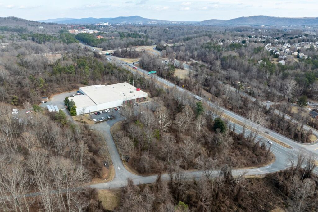
Major Projects Within Albemarle’s U.S. Route 29 Corridor

The projects listed below are currently in development in Albemarle County. As we learn more about these projects, we will continue to update you on ways to advocate for smart growth and resource protection. We’ll also remain focused on wider implications for land use, smart growth planning, transportation, infrastructure, natural resources and quality of life in our community.
In Albemarle County’s process for adopting the fiscal year 2026 budget, the Board of Supervisors and county staff have discussed the importance of expanding revenue from non-residential sources. However, absent from those discussions have been specific details about how much growth will occur by cultivating these new projects, how much that growth will cost and what are the possible impacts we need to plan for are.
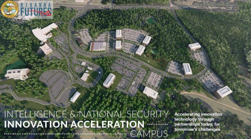
Rivanna Futures
Last year, Albemarle County acquired 462 acres of land along the east side of U.S. Route 29 North adjacent to Rivanna Station, the home of three federal defense intelligence agencies, with the goals of retaining those Department of Defense installations and expanding the private sector in the community. The project is called Rivanna Futures.
An initiative with such goals will most certainly have major land use, transportation, water, energy, and infrastructure implications for the county and its residents, especially for the 8-mile stretch of U.S. Route 29 going up to the southern edge of Greene County.
GO Virginia “Innovation Corridor”
A state-wide economic development initiative called GO Virginia seeks to designate the U.S. Routes 15 and 29 as a Defense and Intelligence Industry Corridor. This would expand defense and intelligence development throughout the area from Fauquier County, down through Culpeper, Orange, and Greene Counties, and culminating in Albemarle County and Charlottesville.
In April, GO Virginia awarded over $613,000 in funding to the County for infrastructure design of Rivanna Futures.
A proposed new vision for U.S. Route 29, transforming the area into an economic development-focused “innovation corridor,” has the potential to impact the environment, transportation, land use, housing, schools and the climate.
This vision is shared by Albemarle County, UVA, the UVA Foundation, and others, with a major focus on growing the defense intelligence and biotech/biomedical economic sectors extending from Charlottesville and UVA along U.S. Route 29 to just north of Ruckersville in Greene County. It is also part of a regional effort to establish an “innovation corridor” along the 60 miles of U.S. Route 29 between Fauquier County to Charlottesville.
Project VITAL: Virginia Innovations and Technology Advancements in Life Sciences
Following the groundbreaking for UVA’s Manning Institute for Biotechnology in 2023, Governor Youngkin announced that a network of research institutions will be established between the University in Charlottesville, Virginia Tech’s Fralin Biomedical Research Institute at VTC in Roanoke, and Virginia Commonwealth University’s Medicines for All Institute. Initially branded as Virginia’s Research Triangle, Old Dominion University in Norfolk, Va. was later added to the research network. The announcement emphasized the desire for increased commercialization between the four cities, similar to North Carolina’s Research Triangle. UVA officials have estimated that the Manning Institute will generate hundreds of jobs and potentially thousands indirectly by attracting biotech and pharmaceutical companies to the greater Charlottesville/Albemarle region — focusing on bringing in new talent from outside that region.
Consider, will these projects bring an influx of people and their families to the region? What will this mean for traffic, schools, housing, cost of living, pollution, and climate? The community has had much to say about these topics in recent years as traffic and the cost of living have increased. Where is this deeper analysis happening, and can the county make it public for feedback from its citizenry?
Haven’t heard much about these major projects? Likely others haven’t either. So, send this to a friend and have them join our mailing list to stay informed about what’s going on in Albemarle and Charlottesville and ways you can get involved.
Thank you!
Rob McGinnis, PLA FASLA
Senior Land Use Field Representative
Albemarle & Greene Counties
[email protected]
(434) 962-9110
AC44 | Feb. 11: Economic Development Survey Closes
This text was taken from an email sent Feb. 7, 2025. Sign up for email alerts →
Thus far in the Albemarle Comprehensive Plan update process, there has been limited discussion about the County’s focus on growing the defense intelligence and biotech/biomedical economic sectors, despite their potential for impacts on the environment and current and future residents’ quality of life.
Therefore, we encourage you to take the Economic Development Strategic Plan Questionnaire by this Tuesday, Feb. 11 at 5 p.m. in order to have your feedback considered while decisions are being made. Current and proposed projects include the County’s Rivanna Futures initiative proximate Rivanna Station, where the federal National Ground Intelligence Center, the Defense Intelligence Agency, and the National Geospatial-Intelligence Agency are located and the growing biotech sector centered at the UVA Manning Biotech Institute. Read on for more on economic development in the County, plus an update on upcoming AC44 meetings.
The Thriving Economy chapter of the AC44 comprehensive Plan update will eventually address the County’s economic development policies, goal statement, objectives, and actions and will be reviewed during future Planning Commission and Board of Supervisors work sessions this year. But we want to ensure AC44 doesn’t leave the following questions unanswered:
- Will the County address not just the beneficial impacts of growing these and other economic sectors, but also avoiding, minimizing, and mitigating potential transportation, land use, energy, environmental, and climate-related adverse impacts?
- Are there sufficient appropriately zoned parcels in the current Development Areas that can accommodate the projected growth of these sectors over the next twenty years?
- How will the growth of these sectors impact housing availability and affordable housing?
Economic Development in Albemarle
The Albemarle County Economic Development Office is in the process of developing a Strategic Plan to examine the County’s assets and prioritize the actions that will most effectively support the County’s economy. The Strategic Plan will serve as a guide for maximizing the community benefit of economic development activities. PEC is the only environmental advocacy organization serving on the Strategic Plan stakeholders committee. Project Enable is the current strategic plan, which advocates for supporting the initiatives below.
The Economic Development Office has released a survey asking residents for their opinions on how the local economy could improve and economic development priorities. We encourage you to share your thoughts in the survey, in particular on Question 6: “What are potential areas of improvement for the County’s economic development initiatives?” PEC is advocating for intentional planning to identify and address potential impacts of economic development to the area’s transportation, land use, quality of life, taxes, housing and affordability, schools, infrastructure such as utilities, and climate. Currently, we don’t see this addressed in the AC44 Comprehensive Plan process.
This underscores the importance of asking the County to consider undertake an assessment of potential impacts of economic development–beneficial and adverse–and to develop AC44 Comprehensive Plan policies to address potential impacts.
Albemarle County’s Rivanna Futures
In fall 2024, Albemarle County acquired 462 acres of land along the east side of Route 29 North adjacent to Rivanna Station, the home of three federal defense intelligence agencies, with the dual goal of retaining those Department of Defense installations and expanding the private defense sector in the community – called Rivanna Futures. Rivanna Futures has been described as the catalyst for a Silicon Valley at the onset along U.S. 29 North, part of a proposed Defense/Intelligence Innovation Corridor extending along U.S. 29 from Fauquier County to Charlottesville.
An initiative with such goals will most certainly have land use, transportation, and infrastructure implications for the County and its residents, especially for the eight-mile stretch of U.S. 29 from Rivanna Station up to north of Ruckersville in Greene County where two new technology and research and development districts are located.
UVA’s Manning Biotech Institute
Ground has been broken at UVA’s Fontaine Research Park for a building to house the Paul and Diane Manning Institute of Biotechnology. This new facility will serve as a catalyst for innovation and to stimulate collaboration throughout the state by bringing together world class researchers in biotechnology. The UVA facility, along with biotech, life sciences, and pharmaceutical manufacturing facilities at Virginia Tech, VCU, and Old Dominion University, will form a collaborative network branded by Governor Youngkin as Virginia’s Research Triangle. The Manning Biotech Institute will also serve a critical role in catalyzing the Charlottesville/Albemarle region’s growing biotech economic cluster supported by the non-profit CvilleBioHub, a non-profit an organization of well over 75 regional companies.
Looking Ahead in AC44
The Planning Commission and then the Board of Supervisors will be reviewing the draft Parks, Recreation, and Open Space chapter during work sessions Tuesday, Feb. 11, and Wednesday, Feb. 19, respectively. There will also be an additional Board of Supervisors work session Wednesday, Feb. 12, to address updated draft Rural Area Land Use and draft Development Areas Land Use chapters, and an updated Growth Management Policy. These updated chapters will incorporate past review comments by the Planning Commission and the Board of Supervisors.
PEC will of course be paying attention to those work sessions, in addition to a planned future Board of Supervisors discussion specifically focused on the value of conservation easements – a discussion aligned with our earlier concerns about the County’s AC44 proposal to explore a cap on conservation easements. We will continue to highlight land conservation’s impact as a natural climate solution and how investment in land conservation works for the public good providing critical benefits like flood protection and clean drinking water to our community.
Upcoming AC44 Comp Plan Update Dates
- Tues., Feb. 11: AC44 Planning Commission Work Session: Draft Parks & Recreation Chapter
- Wed., Feb. 12: AC44 Board of Supervisors Work Session: Rural Area Land Use, Development Areas Land Use & Growth Management Policy
- Wed., Feb. 19: AC44 Board of Supervisors Work Session: Draft Parks & Recreation Chapter
Stay tuned and share this email with those interested in engaging with Albemarle’s future and sign up for the County’s alerts to hear it from them first.
Thank you!
Rob