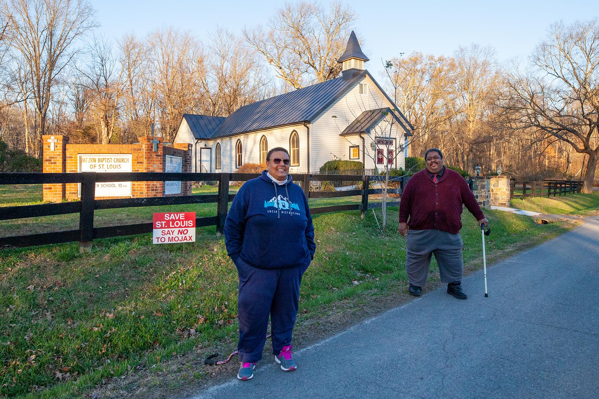
In 2018, a housing development project was proposed on the former Howard property. PEC has worked with Friends of St. Louis and others in the community to push back against this proposal. Learn more >>
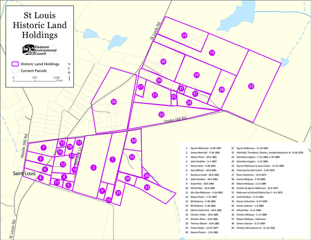
Encompassing approximately 10 acres in the village of St. Louis, the former Howard property, identified as #22 in the map above, is a heavily wooded area bounded by a historic road known as the Old School House Road to the west, State Route 744/Snake Hill Road to the south, and Hamlin School Lane to the north. The proposed property has numerous historic resources that contribute to the historic fabric of the village of St. Louis, including a large cemetery, two home sites and a historic road. This property was one of the earliest acquisitions of land in the present day village of St. Louis, having been purchased by members of the Howard Family (and related families), believed to be former slaves of William Seaton. Shortly after acquiring the land, the Howards built two houses on this property (and a third nearby, outside of this parcel), established a cemetery, and contributed to the overall development of the village.
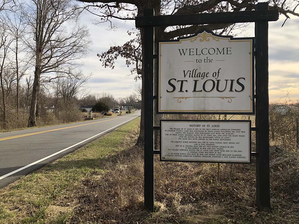
The property is important for its role in the development of the village of St. Louis, which eventually became one of the largest African-American communities in Loudoun County. The property remained in the hands of the Howard family from 1876 until it was sold to the current owner in 2017. The property was determined eligible for listing in the National Register of Historic Places by the Virginia Department of Historic Resources in May 2020, as part of an expansion of the boundaries for the National Register – eligible St. Louis Historic District.
Property Chain of Title
| Date | Grantor | Grantee | Size | Liber: Folio |
| 10-17-2017 | Mary P Canady and James G Peterson Heirs of Albert Ray Howard (d. 2016) | MOJAX, LLC | 10.01 acres | 20171017:64911 |
| 11-30-1979 | Carter E Howard and Mary H Howard | Albert Ray Howard | 17.478 acres | 748:234 |
| 12-13-1971 | Salina Howard and Angie Taylor | Carter E Howard Mary H Howard | 17.478 acres | |
| 9-13-1916 | Winfield Howard | Angelina Taylor | 17.56 acres | 9A/315 |
| 8-16-1876 | William Seaton | Winfield Howard & others | 17.56 acres | 6I/315 |
| 8-3-1876 | William Hibbs & Wife | William Seaton | 17.56 acres | 6I/314 |
| 12-6-1870 | B. P. Noland, Special Commissioner | William H. Hibbs | 37 acres, 3 roods, 15 poles | 6G/209 |
Historically, the 10-acre property was part of a larger estate owned by Alfred Anderson. William Hibbs purchased 37 acres of land in 1870, out of the chancery suit Leith v. Anderson (1873-075) involving Anderson’s estate, after his death, in turn selling a portion of this land to William Seaton in 1876 [1]. William Seaton was a slave owner that resided in the southern district of Loudoun County, Virginia, near Thomas Glascock (who sold acreage to free African-Americans in the area around St. Louis in the 1870s). William Seaton purchased approximately 17.5 acres of land from William Hibbs on August 3, 1876. He sold this tract of land to Charles H. Howard, Theodore Howard, Waneford (Winfield) Howard, Joseph B. Howard, Nancy Corbin, and Edith Jackson less than two weeks later on August 16, 1876 [2].
This property was one of the earliest acquisitions of land in the present day village of St. Louis, having been purchased by members of the Howard Family (and related families), believed to be former slaves of William Seaton.
In the 1860 U.S. Federal Census Slave Schedule, William Seaton is shown owning 16 enslaved individuals, including nine males, and seven females. In the 1870 US Federal Population Census, William Seaton had 17 African-Americans in his household. A comparison of the ages and sex of the enslaved individuals from the 1860 Slave Schedule with those individuals shown in the 1870 Population Census, there is a relative match for 10 of the 12 individuals, who were alive and could have been represented in the 1860 census [3]. Additionally, William Seaton is connected to at least some of those individuals shown in his 1870 household, through slave birth records. Loudoun County’s slave birth records show “Sarah” giving birth to “Joseph” in September 1859 [4]. Joseph B. Howard, one of the purchasers of the 17.5 acre tract is the same age as the Joseph found in the birth records, and strong evidence that they are the same person.
In 1916, Winfield Howard, one of the original purchasers of the 17.5-acre tract, sold the land to his daughter, Angelina Taylor. The property remained in the Howard Family for years. It was purchased by Carter Howard, grandson of Theodore Howard (one of the original owners) and his wife, Mary Howard, at a delinquent tax sale on December 13, 1971. Carter and Mary Howard sold it to Albert Howard on November 30, 1979. It was owned by Albert Howard until his death.
Robinson – Howard African-American Cemetery
Encompassing approximately one tenth of an acre in the village of St. Louis, the Robinson-Howard Cemetery is the historic burial grounds of former slaves and their descendants who once resided in the area around present day St. Louis. The cemetery stands in a flat, heavily wooded area east of an old road, locally known as the Old School House Road with burials laid out in an easterly-westerly orientation in four long rows. The cemetery was likely established in the 1870s and in continual use up through at least the 1930s. A Phase I archaeological survey located 23 grave shafts but the results of the survey suggest there could be closer to 50 burials in the cemetery, including infants, children and adults. The site includes largely unmarked grave sites.
Cemetery Interments:
The following list of possible interments are inferred based on death certificate burial locations, census records, as well as the land ownership connection to the person being interred.
| Name | Age at death | Burial/Death Date | Family | Burial Location (if given on death record) |
| Winfield Howard | 70 | 10/7/1916 | Son of Charles Howard and Sarah Carter | St. Louis |
| Theodore Luke Howard | 76 | 12/15/1922 | Son of Charles Howard and Sarah Carter | Burial “near home” |
| Mary Elizabeth Adalaide Howard | 36 | 12/24/1915 | Unknown | St. Louis |
| James Howard | 50 | 12/4/1931 | Son of Charles & Adalaide Elliott Howard | St. Louis |
| Infant/child | Between 1886 and 1900 | Child of Winfield Howard and second wife, Mary | Not given (based on census information) | |
| Joseph Howard | 10 months | 20 June 1880 | Son of Charles & Adelaide Howard | Not given |
| Burwell Howard | 1 year | 25 June 1887 | Son of Charles & Adelaide Howard | Not given |
| John W Howard | 17 | 11 October 1893 | Son of Charles & Adelaide Howard | Not given |
| Lucy Robinson | 20 | 30 May 1894 | Daughter of Squire & Lucy Robinson | Near Leithton |
[1]Loudoun County Circuit Court. Leith v. Anderson. 1873-075. Library of Virginia Chancery Records. https://www.lva.virginia.gov/chancery/
[2]Charles H. Howard, Winfield Howard, Theodore Howard, Nancy Corbin nee Howard, Edith Jackson (Eda B. Howard), and Joseph Howard are all shown as African-Americans in William Seaton’s household in the 1870 Population Census. 1880 U.S. census, Loudoun County, Virginia, population schedule, Southern District,, sheet 225B, [dwelling and family number illegible], William Seaton.
[3] Five of the individuals in the 1870 census were children born after 1860
[4] Loudoun County Slave Issues, Births 1853-1859. Loudoun County Clerk’s Office, Historic Records Division, accessed from: https://lfportal.loudoun.gov/LFPortalInternet/0/edoc/326213/Slave%20Issues%20Births.pdf