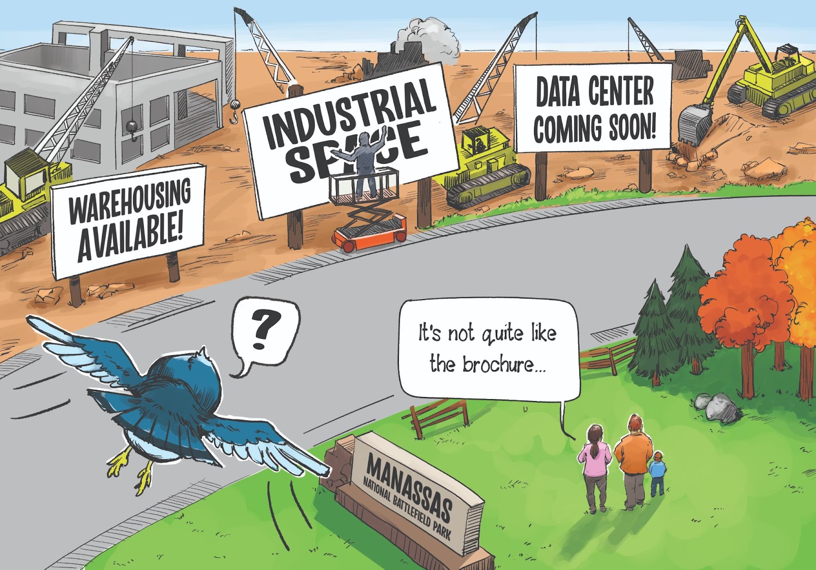
The rural area of Prince William County, also known as the “Rural Crescent,” is under threat. Three different proposals are being considered, each unique in scope, but together represent the urbanization and industrialization of the remaining rural lands in Prince William County. The future of farming and tourism in the region, as well as critical historic, water, natural and scenic resources, including Prince William’s two national parks, is at risk. In fewer words, the destruction of the Rural Crescent.
Public engagement on these major decisions is critical. Once Prince William begins to erode its rural areas, these areas will become harder and harder to protect as the county becomes steadily consumed by creeping industrial growth. Residents must encourage the county to focus investment on existing communities rather than infrastructure to support speculative proposals in rural areas.
1. Digital Gateway: Encouraging Industrial Sprawl

The “Digital Gateway” proposal appears to be an attempt to make cheaper rural land available for the benefit of speculative developers.
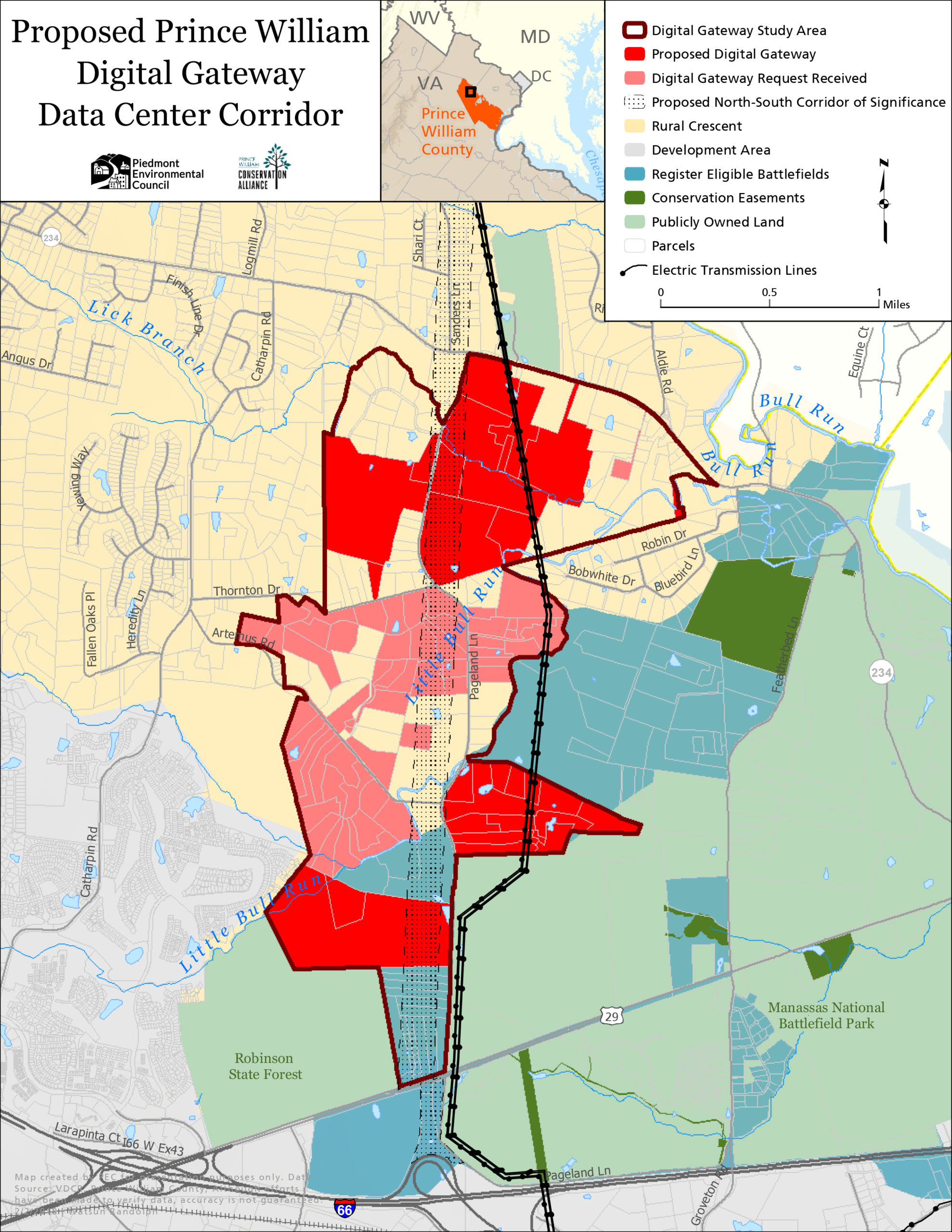
Pageland Lane is located on the west side of the Manassas National Battlefield Park and runs north to Rt. 234. The landscape along the road is rural, and although large transmission lines are present on the parkland and several private properties, they are generally hidden by the trees as you drive along the road. The proposed “Digital Gateway” would drastically change this landscape forever.
Although the moniker, “Digital Gateway,” implies data centers, the proposed land use designation of technology/flex allows for a much, much broader set of uses. Under this designation, Pageland Lane residents and travelers could see everything from distribution warehouses to industrial office parks to data centers. This land use designation would involve heavier traffic projections, especially tractor trailer traffic.
The proposed “Digital Gateway” area comprises 2,139 acres of land currently planned and zoned for agricultural use.
This proposal will negatively affect tourism at the national park, decrease water quality, hurt the agricultural economy, and destroy wildlife habitat. It will also require massive infrastructure investment. Pageland Lane is currently a rural two-lane road leading from Rt. 29 to Rt. 234. However, this change in land use designation would necessitate widening of Pageland Lane and the construction of a Rt. 234 Bypass North Extension. This extension was previously removed from the county’s plan in 2015. Water and sewer infrastructure would likely need to be extended/expanded to accommodate the industrial uses.
2. Data Center Opportunity Zone Overlay
Prince William County already has a plan for data centers that was developed through a community process and identified appropriate areas for data center development to minimize impacts on surrounding communities. Additionally, this Data Center Opportunity Zone Overlay was designed to accommodate data center development in areas with adequate infrastructure to support it.
The existing overlay covers around 8,700 acres. By comparison, in Loudoun County—the largest data center market in the world—data centers currently occupy about 2,000 acres. Within the 8,700 acres of the existing overlay, Prince William County has determined that 2,493 acres are vacant and readily available for data center development. With so much land already available, rezoning rural land should be out of the question.
Data centers themselves are only one piece of the puzzle. Another piece is the industrial development that can accompany them. Recall that data centers require significant amounts of energy and water to function. Many of them require gray water from wastewater treatment plants, which is an entirely different infrastructure than required for public drinking water. Rural areas do not have gray water infrastructure, and often lack other infrastructure needed if data centers are to be built.
Often when new power lines or water infrastructure is built, additional development is approved to make the most use of that infrastructure. Industrial development is often sited next to massive data centers: warehousing, storage, energy production, manufacturing and distribution. These types of facilities, in turn, require expanded road infrastructure. We are concerned about the steady encroachment of industrial sprawl that could drastically alter the Rural Crescent and eliminate the rural portion of Prince William County entirely over time. To learn more about this proposal, view our story map.
3. Comprehensive Plan Update
The comprehensive planning update (“Pathway to 2040“) process was started in 2018. In 2019, the county shared some of the plans for the Rural Crescent, which were met with significant controversy.
Since then, these controversial aspects have not been discussed during outreach events. However, they still appear to be lurking in the background.
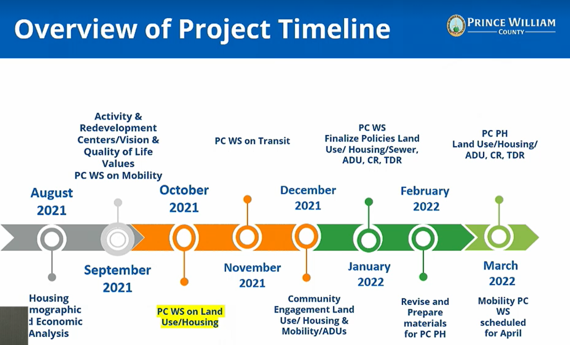
During a work session with the planning commission on October 21, 2021, staff shared a timeline for the Comprehensive Plan Development that included upcoming worksessions on TDRs (transfer of development rights) and updates to the sewer chapter. Although housing was discussed in detail, there was very little discussion about land use, and no future land use map was shared. Without a future land use plan, it’s impossible to know what the future transportation plan and the sewer plan will look like. This lack of transparency is extremely frustrating. Without a future land use map, there is nothing for the planning commission to comment on and little information for the public about where we are headed.
What you can do
- Contact your Board of Supervisors representative
- There are still November and December meetings of the Board of Supervisors planned in 2021 which you can attend.
- Contact the Planning Commission
- There are upcoming Public Commission public hearings on November 17, December 1 and December 15 which you can attend.
- Provide feedback on the Comprehensive Plan Update. Visit the Pathway to 2040 main page to get involved with the planning process.
Learn more about these threats
- View our StoryMap: Is that a Data Center in the Fields?
- Watch a July 2021 press conference on data center impacts to the Rural Crescent
- Learn more at the Grow Smart Prince William website