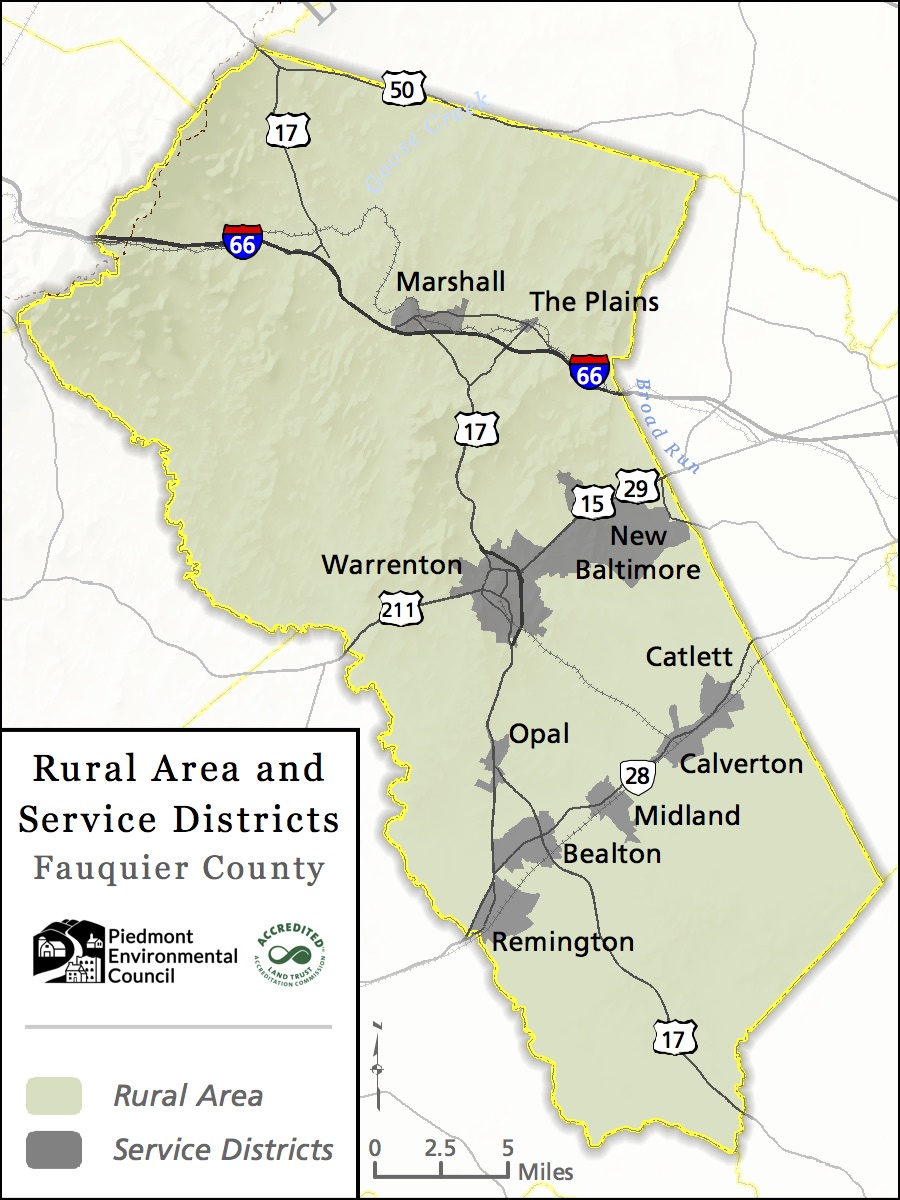
The Rural Lands Plan is a section of the Fauquier County Comprehensive Plan, and much as the name implies, it outlines land use policies and the desired future for the rural areas. This chapter is very important because over 90% of the County is planned to remain categorized as rural land. Although the majority of new growth is happening within the growth areas of the County (e.g. Warrenton, Bealeton, New Baltimore, etc.), about half of the nearly 70,000 residents of the county live in these rural areas. In addition, all residents of Fauquier are connected to the rural lands by locally grown goods, through tourism, and by simply driving through them.
The Rural Lands Plan is out of date and is due for an update after nearly two decades. The new draft developed by Fauquier County staff is generally good, however PEC has some concerns. While a recognition of the value of our rural lands is clearly laid out, some of the policies for implementation are misguided (more on that below) and we believe some topics included do not belong in this chapter of the Comprehensive Plan. Below is a list of suggestions we have for improving the draft plan so that the policies in the plan will bring about the community’s desired vision.
The County has held work sessions for the Board of Supervisors and Planning Commission, but there is still time for the public to make their voices heard. Written comments are currently being accepted and public hearings will likely start in September or October of 2018. Please send your comments to [email protected].
Room for Improvement
PEC will be delivering more detailed formal comments to County staff and the Board of Supervisors throughout the process, however, here are some of our overarching concerns with the draft. As always, please feel free to share with us any additional thoughts you have. Julie Bolthouse, PEC’s Fauquier County Land Use Representative, can be reached at [email protected] or 540-347-2334 x7042.
Viewshed Protection: The County has developed a new model for viewshed analysis of the County landscape and there are new tools available for terrain modeling and development simulation. The plan recognizes these new tools but needs to go a step further by providing basic identification of primary viewshed corridors and iconic scenic assets in need of protection. As the County updates and develops ordinances, clear identification of what the County considers to be a primary scenic viewshed or iconic scenic asset is vital.
Environmental Features: The plan focuses mainly on the agricultural value of the rural land. There is little mention of natural resources, ecosystem services, or existing parks that exist in tandem with agriculture and residential in our rural landscape. These resources should receive clear recognition and value in the rural lands plan to make it clear that things like protection of wetlands, preserving riparian buffers, creation of wildlife habitat areas are also high value uses of the rural land in Fauquier County.
Development is Not a Zero Sum Game: The section on septic and wastewater management states that,
“A key aspect of the County’s vision for protection of its rural lands hinges on the provision of adequate water and wastewater facilities in the Service Districts to accommodate an adequate level of growth. This serves to relieve development pressure in rural areas and supports the vision for protecting rural character and agriculture in rural lands.”
We support improvements to water and wastewater infrastructure to better serve existing residents and businesses but we believe new development should pay for the expansions in infrastructure that they require. Expanding infrastructure may in fact attract more residential and commercial development to the service districts, but it will not discourage it from also coming to the rural lands. Fauquier’s service districts are appropriately sized to accommodate natural population growth with hundreds of acres of land planned for additional residential development. Providing infrastructure in these areas would simply recruit growth faster than the market would naturally bring it.
Loosening of Wayside Farm Stand Regulations: The plan calls for loosening of language regarding wayside stands. Several of these are changes that we support such as allowing stands under 400 square feet to remain as permanent structures rather than having to be taken down after each growing season. However, we are concerned about permitting of “limited sales of non-locally produced items such as cold beverages” which we do not feel should be allowed by-right as a part of a wayside farm stand.
A wayside farm stand is not a restaurant or food truck – it is defined in the ordinance as a structure designed for the display and sale of agricultural products with no space for customer seating within the structure. It is allowed without any regulatory oversight because of how limited the impact of the use would be. If the use is expanded to include non-locally produced items such as cold beverages it becomes more of a farmers market which is allowed by special permit and includes addition standards regarding egress, ingress, parking, etc. These additional standards are necessary because of the additional impact this more expansive use would have.
New “Agriculture Support Zones” and Allowance for Industrial Activities in Rural Areas: Access to agricultural equipment and supplies is important for the agricultural community and we support having equipment sales, rental, repair services, cold storage, distribution centers, seed supply, etc. in the County. However, no changes to the zoning are needed to allow for these uses and such changes should not be encouraged in this plan. Currently small contractor yards and repair services are allowed as a major home occupation with a special permit.
More intensive uses such as cold storage facilities, distribution centers, equipment sales, etc. are allowed in industrially zoned, often by-right without legislative review. Industrially zoned land is located throughout the County in close proximity to rural lands in service districts such as Midland, Marshall, Opal, and the Town of Warrenton.
Questions? Contact PEC’s Fauquier field representative, Julie Bolthouse, at [email protected].